
Baviaanskloof River
- Overview
- Geophysical
- Hydrology and Geohydrology
- Ecology
- Climate
- Land-use
- Populated Places
- Water Infrastructure
- References
Overview
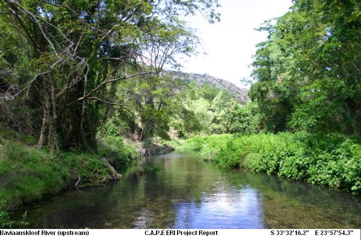
The Baviaanskloof river rises in the rugged mountains flanking the narrow Baviaanskloof Valley running parallel to the Langkloof.
The Kouga River, which rises in the Langkloof has the isolated Baviaanskloof River as its major tributary.
The Baviaanskloof lies roughly 120 km west of Port Elizabeth in the Eastern Cape. The gorge with dozens of smaller valleys leading into it, can be explored by traveling along an untarred road that cuts its way down through the Winterhoek Mountains in the North to the Gamtoos Valley in the South. This Wilderness area, a U-shaped reserve currently occupying 180 000 hectares, is named after the baboon commonly found in the area. (www.camdeboocottages.co.za/baviaanskloof.html )
The Baviaanskloof lies between latitude 33° 27’ to 33° 50’ S and longitudes 23° 24’ to 24° 51 E, immediately north of the Kouga catchment and the Kromme River catchment.
Geophysical
Topography
As part of the Cape fold belt the area is characterised by relatively high mountains, including the highest peaks in the South Easter Cape (Cockscomb 1 758 m and Smutsberg 1 757m). The average height of the three parallel east south-east mountain ranges, the Baviaanskloof, Groot Winterhoek and Kouga mountains is more than 1 200m above sea level.
From the peaks the slopes fall steeply to the north and south to end on a plateau level (the Mica land surface) of 650 to 900 m above sea level. Only a few ridges of this formation survive. The rest of the former land surface was carved away by deep ravines reaching a valley at an altitude of between 550 and 320 m above sea level. This valley includes the Kouga, Baviaanskloof and Groot River valleys.
The topography is rugged and deeply folded. A steep outer ring of high mountains forms the water shed, with an inner area of subdued relief. These plateaus at 650-900m ASL and represent old mature land surfaces (African Land Surface – ALS -120 mill. Yrs. ago). Similar features can be seen in the Kromme River valley. The internal floodplain is divided into large alluvial basins by erosion-resistant, higher lying ground (Map). The altitude of the valley floor: 300 – 700m asl., the lowest point in the catchment, being the confluence with the Kouga River at < 160 m above sea level (asl). Scholtzberg (1626 m) and Smutsberg (1758 m) are the highest points on the northern and southern watersheds respectively. Slope gradient of mountains 30 – 40%, 60% in some areas. Only about 30% of the area has a slope of less then 30%. The slope dictates a lower energy capacity than the rainfall intensity would normally indicate. On the steep slopes the soils are shallow and frequent slope failures are visible throughout the entire length of the valley (Rust and Illenberger 1989).
Soils
Deep soils occur only on the flatter areas of the Baviaanskloof on the African Land Surface plateaus and valley floor. These are the areas where wetlands can be expected. However the soils are of the stratified alluvial Dundee type, which have high drainage with some clay in places (detailed analysis only from Sewefonteine). This factor alone mit igates against formation of wetlands other than along the riverbanks.
Hydrology and Geohydrology
Hydrology
The main drainage systems flow in the valleys, mainly in an easterly and southerly direction. Smaller streams flow northwards on the northern slopes of the Baviaanskloof Mountains and westwards from the watershed on the Uniondale side of the area.
The MAR from the BRC (MAR = 45.8 106m3) constitutes 9% of the MAR from the Primary Gamtoos River catchment (MAR = 495.2 106m3) (Midgley et al., 1994). The rainfall intensity of the area is II to III in the Baviaanskloof area. The average annual rainfall on the north facing slopes of the Kouga Mountains, which drain into the valley, is 448 mm, while that of the south facing slopes of the Baviaanskloof Mountains that drain into the valley is 461mm. The 72-yr. long rainfall record from Zandvlakte station, the furthest west, shows that Feb/March and November are the wettest months, June/July the driest and that during the remaining seven months between 20 and 30mm can be expected. At the Studtis station, halfway up the valley less rain was recorded in late summer than at Zandvlakte. The easternmost station is Voorkloof, with a twenty years record and the profile is similar to that of Studtis. Thunderstorms, flash floods and large floods are regular occurrences in the valley (10-20 Thunderstorms/ year – Kerley & Els 1989). Until recently snow occurred frequently during winter (Tyson 1971 & Bond 1981).
The MAP is typically 20% of the MAE lending to arid conditions throughout most of the catchment. The short but intense duration of the rain coupled with the overall steep topography, high evaporation and infiltration rates lead to a predominance of ephemeral streams. As a result of these climatic and geological conditions, wetlands are relegated to the lower catchment areas, in particular the floodplains adjacent to the Rivers. This is evidenced by the large percentage of floodplains recorded.
Ecology
Terrestrial Animals
The majority of game found in the Cluster has been re-introduced and includes Cape Mountain Zebra, Red Hartebeest, Cape Buffalo, Eland, Kudu, Mountain Reedbuck, Duiker, Grysbok and Grey Rhebok.
Also common are Aardvark, Aardwolf, Cape Clawless Otter, Honey Badger, Bushbuck, bush pig, leopard, Bat-eared Fox and Caracul as well as Chacma Baboon and Vervet Monkeys
The area has a high biodiversity, including 58 mammal species, 293 bird species and 11 fish species, three of which are indigenous. Numerous species are Red Data listed, including leopard (Panthera pardus), Cape mountain zebra (Equus zebra zebra), and grey rhebok (Pelea capreolus).
The Cape Buffalo and Mountain Zebra have been re-introduced to the area and the rare Cape Leopard is also seen from time to time. Numerous encounters with baboons are of course a certainty.
Vegetation
Five veld types (Vlok 1989):
- Afromontane Forest
- Subtropical thicket (Valley bushveld, Spekboom veld)
- Fynbos (wet, mesic and xeric Mountain fynbos and Grassy Fynbos)
- Cape Transitional ( South Coast Renosterveld)
- Karoo shrublands
Baviaanskloof is well known for its endemic plant species.
No fewer than seven of the country’s eight biomes – the highest level of ecosystem recognized by ecologists- are represented in the broader Baviaanskloof area- these are :
- Fynbos
- Sub-tropical thicket
- Namma -Karoo
- Succulent Karoo
- Grassland
- Savanna
- Forest Biomes
The Baviaanskloof Nature Reserve alone houses over 1100 species of plant, 20 of which are known to be endemic. 52 species are categorised as Red Data Book species. Expanding the list to Groendal and Formosa Nature Reserves could add as many as 100 species.
Climate
Temperature
High daily and seasonal temperature fluctuations occur in the area. Temperatures of 44° C occurring as a result of warm winds from the high plateau are not uncommon.
Night temperatures can be relatively cold with differences of up to 28°C between day and night temperatures.
The average daily minimum temperature is about 15°C in January and 5°C in July, with extremes varying between 5°C in and -3°C.
Frost occurs from the beginning of June to end of August.
In summer the prevailing wind direction is south to southeast, and in winter the prevailing wind direction is northwest. Dry hot berg winds are experienced during autumn and particularly winter (BWA Management Plan 2001).
Rainfall
The annual average rainfall is more or less equally distributed over the year, with a tendency to reach a maximum in March and November (Tyson, 1971). The proportion of summer rainfall in the area increases gradually towards the east.
The rain is mostly cyclonic and orographic in nature with frequent thunderstorms (10 to 20 per annum) in the summer months (Bond, 1981).
Snow occurs annually on the high mountain peaks.
Land-use
Agricultural
Farming with sheep, goats and cattle
Nature Conservation, Reserves and Tourism
Baviaanskloof Reserve
Populated Places
| Town | District | Municipality | River / Tributary |
|---|---|---|---|
| Steytlerville | Cacadu | Baviaans | |
| Willowmore | Cacadu | Baviaans |
Water Infrastructure
Dams
| Name | Capacity (mil.cub.meters) | Comments |
| Kouga | 128 |
References
ECPB- Baviaanskloof Cluster Strategic Management Plan, 2007