Verlorenvlei Estuary
- General Information and Location
- Catchment Characteristics
- Land and Estuary Uses
- Ecology
- Hydrodynamics and Mouth Dynamics
- Physical Features
- Climate
- Threats
- References
General Information and Location
General
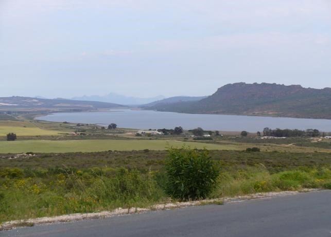
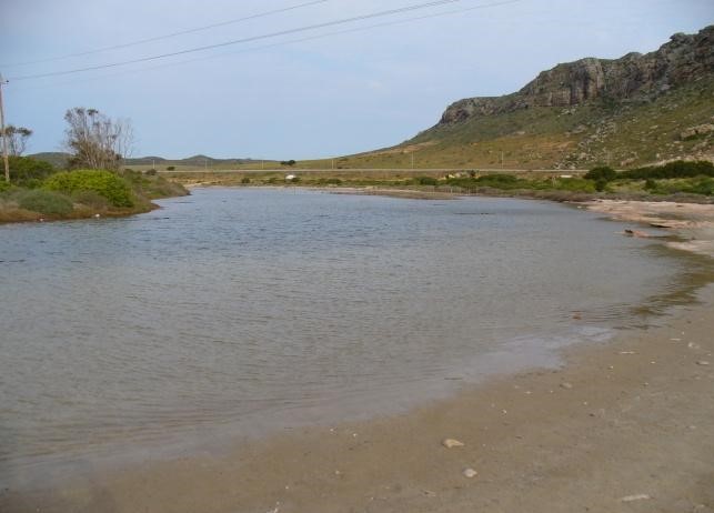
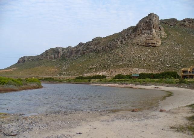
Verlorenvlei is approximately 25 km north of Lambert’s Bay, near Eland’s Bay. With and area of 1 500 ha, it is one of the largest lakes and one of the country’s few coastal freshwater lakes. The catchment of the lake is about 1 890 km2 in extent (Ref. 5). A small estuary connects the lake to the sea and marshlands are present along the main river which enters the lake. The Verlorenvlei stretches between the West Coast villages of Elandsbaai and Redelinghuys.
Location (co-ordinates)
Verlorenvlei is located in the Western Cape (32º24’S 018º26’E
Dimensions
Approximately 1 500 ha.
Catchment Characteristics
Main Rivers and tributaries
The catchment is about 87km long in a north-west/south-east direction and up to 43km wide. Its surface area is estimated (Ref. 5) to be 1 890km2, or 198 000 ha.
The catchment is bounded by the Swartberg and Olifantsrivierberge in the east and by the Piketberg in the south, and includes the Eendekuil basin, a low-lying area lying between the Olifantsrivierberge and the Piketberg. The Verlorenvlei River and its tributaries drain the entire Eendekuil basin, the Table Mountain Group mountains around Paleisheuwel, the northern outliers of Piketberg, the extensive flats of Tertiary to Recent sands between Het Kruis and Redelinghuys and the 5km strip of low Table Mountain Group hills and sand flats on either side of the lake which contribute seepage.
Geomorphology
Von Harmse (Ref. 3), in his Schematic Soil Map of Southern Africa (1978), classifies the Verlorenvlei area as a zone of littoral sands which are arenosols, or of aeolian origin. He points out that the salient feature of such soils is their low reserve of weatherable minerals, and the low silt/clay ratio. Taylor (1987) describes these coastal lowlands as consisting of sands and conglomerates of Tertiary to Recent origins. He comments on their low water-retaining capacity, being either acid and relatively infertile or, nearer the coast, alkaline with a distinct horizon of lime accumulation. The ‘heuweltjies’ or hillocks have higher clay content than the surrounding soils.
The general Verlorenvlei area is characterized by type a fine sandy soil, in which the dominant types are Fernwood and Mkambathi; the sub-dominant Hopefield; and the rare Langebaan, Sandveld and Sonneblom. On the southern bank, extending from Elandsbaai to Redelinghuys, are isolated sections classified as rock and undifferentiated lithosols.
Rubble and debris are found in numerous places at the foot of cliffs and along small streams that flow down hillsides after heavy downpours. The river is flanked by strips of alluvium, part of it being black and rich in plant material. Several patches of drift sand and bare dunes away from the coast originated mostly from mismanagement of the veld. A large dune field occurs to the north of the river mouth and the town of Elandsbaai.
Geology
The Malmesbury Group (Proterozoic) has been subdivided on purely lithological grounds into three groups, calcareous, quartzose and phyllite with greywacke. The calcareous group comprises pure limestone, dolomitic limestone and dolomite. Carbonaceous patches and calcareous rocks grade into quartz-rich varieties.
Sediments showing a high degree of lithological similarity to the Klipheuwel beds of the type area are found in small occurrences along Verlorenvlei. No angular inconformity is visible between them and the Table Mountain Group but their regional relationships clearly show the presence of an inconformity. Rogers named these rocks Ibiqua Beds, which implies a correlation with the Nama System, for which there is no proof available yet.
The Klipheuwel Formation (Proterozoic) comprises the following: purple to red-dish brown sandy micaceous shale which is mostly poorly-bedded and grades into mudstone; alternating beds of sandstone, shaly sandstone and sandy shale with colours ranging from buff to purple and red; white and brightly coloured sandstone and grit with minor conglomerate and shale layers. The arencaeous strata are commonly cross-bedded, quite often feldspathic, and much softer than the Table Mountain Group sandstone. The maximum thickness exposed on the eastern boundary of this area amounts to about 375m.
White to slightly-reddish sandy soil originated mainly from the underlying unconsolidated to partly-consolidated sand and clay, and to a lesser extent from the Table Mountain Group, the coastal dunes, and fluviatile deposits of past and present drainage systems.
Land and Estuary Uses
Residential
A small village, Eland’s Bay, lies along the coast near the mouth of the estuary.
Agricultural
The surrounding area is privately owned and farm boundaries extend to the 50 year flood line. Fields have been established along part of the lake margins and extend below high water marks in places. Extensive ploughing has occurred in the surrounding area particularly on the hills south of Verlorenvlei. The greater part of the Verlorenvlei wetlands is used as natural veld grazing for sheep and cattle and water is pumped for irrigation purposes and the marshland is used for cattle grazing.
Industrial
Important fishing grounds are found along the coast and four small fish processing factories have been built along the coast at Baboon Point. These factories are mostly concerned with the crayfish industry although a small amount of fish processing does occur.
Ecology
Flora
Algae
Large masses of filamentous green algae, including Chaetmorpha and Cladophora, are common in the channel, particularly between the railway bridge and the lower causeway, where the water is often stagnant and hyper saline.
Aquatic Vegetation
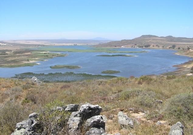
Extensive beds of emergent aquatic macrophytes occur along the margins of the lake with Phragmites australis, Typha latifolia and sedges as dominants. Downstream of Redelinghuys there are fairly wide and open wetlands with patches of mixed sedges and reed communities along the course of the Verlorenvlei River over a distance of 11km. Dense reedbeds are present in the upper part of the lake. Myriophyllum spicatum, a submerged macrophyte, dominates large areas of the lake where the water is about 2m deep. The water lily, (Nymphaea capensis), a species which is becoming rare in South Africa due to destruction of wetlands, occurs in small numbers.
Terrestrial vegetation
The Verlorenvlei wetland is of significant botanical importance, because of its position at the transition between the karroid and fynbos vegetation types. The region therefore, has a high diversity typical of an ecotone area.
The different vegetation types are:
Strandveld – Seaward dune strandveld
- Shrubby strandveld
- Restoid strandveld
- Saltpan vegetation
- Lowland fynbos
- Dry mountain fynbos
- Mountain fynbos
- Karroid scrubland
- Marsh vegetation.
The site also supports notable rare plant species, such as Ferraria foliosa, F. densepunctulata, Cerycium venom (presumed extinct) and Cullumia floccose.
Fauna
Birds
In 1976, 934 and 1 371 waders were recorded respectively during two surveys in the lower reaches of Verlorenvlei (Ref. 7). Of these numbers, 95% were migrants. In a later survey (1983) of the whole Verlorenvlei, 3 655 waders were reported, of which 2 928 were migrants and 727 residents. This same survey yielded a total of 6 829 birds of 60 species in the environs of Verlorenvlei. The vlei also provides feeding, nesting and roosting sites for 200 species of birds in the surrounding area. It is an important moulting area for Egyptian geese (Alopochen aegyptiaccus) and other waterfowl.
Waterbirds seen at Verlorenvlei include herons, egrets, ibises, spoonbills and flamingos. The presence of glossy ibises and African spoonbills is important, since these species are uncommon in the south-western Cape (Ref. 8). Flamingos appear at Verlorenvlei when other vleis, such as Rocher Pan (35km south) and Wadrifsoutpan (13km north) dry up. Flamingos are listed in the South African Red Data Book as requiring conservation (Brooke 1984).
Other Red Data Book species include the little bittern and the Caspian tern. The area is possibly also an important moulting ground and summer refuge for ducks, with 600 Cape shoveller and 1 200 yellow-billed duck being observed in May 1979 (Ref. 1). In addition, Verlorenvlei is a type locality for several species of birds, including the white-backed duck (Thalassomis leuconotus).
Up to 150 great white pelicans were counted by the Fitz Patrick Institute in 1976, representing 26% of the total south-western Cape population (Ref. 8). On 23 March 1982, 212 pelicans were counted. The great white pelican is rated as rare in South Africa, and therefore in need of special protection.
The vlei is also an important feeding area for the rare white pelican (Peleanus onocrotalus).
Mammals
Little information exists on mammal populations at Verlorenvlei. Archaeological and historical evidence suggest that larger mammals were present in abundance in the past, whereas they are non-existent today. A survey by Stuart (1981) indicates the presence of the 12 carnivore species and 11 other mammal species in the vicinity.
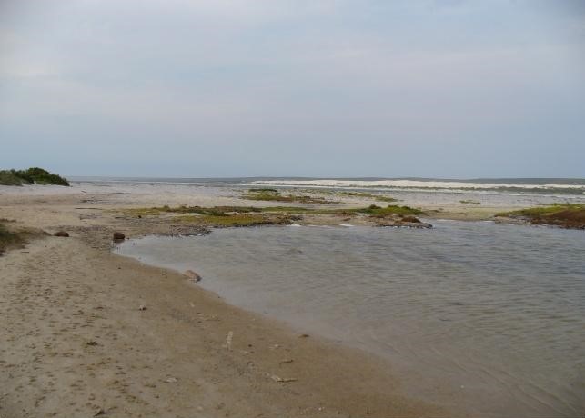
Hydrodynamics and Mouth Dynamics
Hydrodynamics
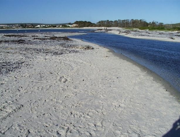
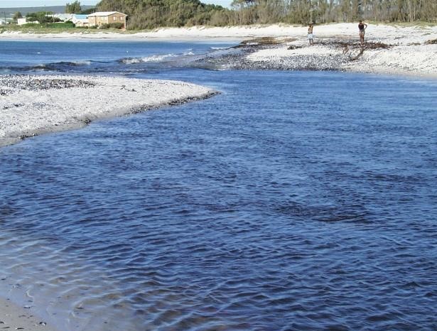
The entire channel is very shallow (about 0,5m deep), tending to inhibit free water circulation. A natural obstruction at the mouth is a rocky sill topped by a sand bar, above the normal reach of high tides. The sand-topping is formed by a south going longshore current, in combination with frequent onshore winds.
Mouth dynamics
The two types of wave-induced inshore currents, one north going and the other southward, appear to keep a hydraulic and sedimentological near-equilibrium at the beach. Consequently, provided the balance (including source of sand) is not disturbed, a sufficient sand supply from the beach will always tend to cover the rocky barrier at the mouth, to such an extent that the mouth has little chance to remain open for any appreciable length of time after breaching.
Physical Features
Topography
The Verlorenvlei Wetlands is between 1 and 5 m above mean sea level. The catchment is about 87km long in a north-west/south-east direction and up to 43km wide. Its surface area is estimated (Ref. 5) to be 1 890km2, or 198 000 ha.
Bathymetry
Average depth of open water area of the lake is between 2 and 3 metres with maximum depth of 5 metres.
Climate
General
Verlorenvlei has a mild, Mediterranean climate, with predominantly sunny days throughout the year.
The highest average maximum temperature (24, 42 °C) occurs in January and the lowest average minimum temperature (8, 7 °C) occurs in July.
Rainfall
Verlorenvlei has an average annual rainfall of 275mm of which an average of 70% falls in the winter half-year (April to September). Single very rare heavy showers can account for as much as the normal annual precipitation. Hail is seldom reported in this region.
Threats
Development pressure in the Verlorenvlei area has been concentrated along the coastline, in the vicinity of Elands Bay. The pressure is beginning to increase in the form of applications for township extensions (Ref. 10). The coastal environs attract weekend and holiday visitors, particularly in the summer, causing short term, seasonal increases in the demand for facilities.
The land and its vegetation cover have been degraded, mainly due to grazing and clearing of land for agriculture and rural settlement. Despite the long history of human use of the area for grazing and cultivation, the level of degradation is presently low enough to allow for natural rehabilitation, but the rate of degradation is escalating. For example, agricultural activities have led to interference with the natural function of the estuarine channel. The culverts in the causeway near the mouth have been blocked to dam fresh water for irrigation of recently cleared land.
Likely sources of threats in the future include:
- Existing and additional obstructions which interfere with natural estuarine and coastal lake dynamics.
- Increases in domestic livestock, particularly goats.
- The clearing of natural vegetation for the extension of agriculture.
- Increased extraction of underground water for irrigation.
References:
- Ref 1. South African Wetlands Conservation Programme: Verlorenvlei. Information sheet for the site designated to the List of Wetlands of International Importance in terms of the Convention on Wetlands of International Importance especially as Waterfowl Habitat. http://www.ngo.grida.no/soesa/nsoer/resource/wetland/verlorenvlei.htm
- Ref 2. Rogers, J. (1980). First report on the Cenozoic sediments between Cape Town and Elands Bay. Pretoria Rep. Geol. Surv. S. Afr. 165:1-64.
- Ref 3. Harmse, HJ, Von M. (1978). Schematic soil map of southern Africa south of latitude 16o30’S. In: Werger, M.J.A. Biogeography and ecology of Southern Africa. Junk, The Hague. pp: 73–75.
- Ref 4. Taylor, H.C., (1978): Capensis, in Werger, M.J.A. (ed), Biogeography and Ecology of Southern Africa, Junk, The Hague, 171-229.
- Ref 5. Noble, RG. and Hemens, J. (1978). Inland water ecosystems in South Africa – a review of research needs. CSIR, Pretoria, South Africa.
- Ref 6. Robertson, HN. (1980). An assessment of the utility of Verlorenvlei water. University of Cape Town.
- Ref 7. Summers, R. W., Pringle, J. S., and Cooper, J. (1976). The status of coastal waders in the south-western Cape, South Africa. Western Cape Study Group. 162p.
- Ref 8. Cooper, J. (1976). The ornithological importance of Verlorenvlei and its value as a nature reserve. Unpublished memorandum. University of Cape Town, Percy Fitz-Patrick Institute of African Ornithology.
- Ref 9. Brooke, R.K. (1984). South African Red Data Book – Birds. S. Afr. Nat. Sci. Prog. Report. 97: 1 – 123.
- Ref 10. Heinecken, T.J.E. and Badenhorst, P. (1985). Elandsbaai extensions 2 and 3. Unpublished report. Stellenbosch, National Research Institute for Oceanology, CSIR.