Berg River Estuary
- General Information and Location
- Catchment Characteristics
- Land and Estuary Uses
- Ecology
- Water Quality
- Hydrodynamics and Mouth Dynamics
- Physical Features
- Climate
- Threats
- References
General Information and Location
General
The river is approximately 294 km long with a catchment area of 7 715 km2.
Location (co-ordinates)
The Berg estuary (32° 46’ S; 18° 09’E) is located in the Western Cape and is found on the west coast, north of the coastal city of Cape Town.
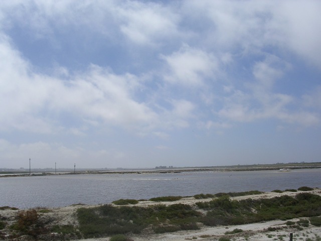
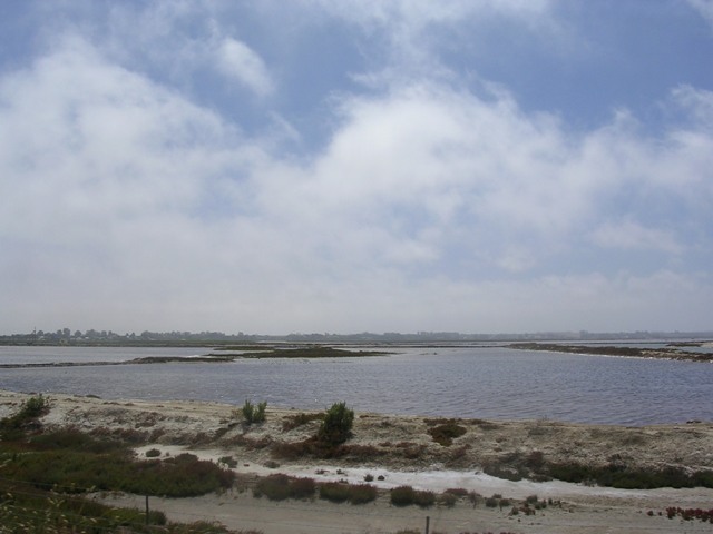
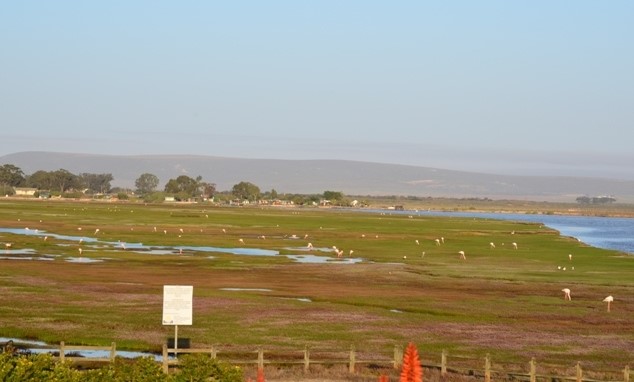
The Berg River estuary is located 140 km north of Cape Town. It is one of the largest estuaries in South Africa and only one of four perennial estuaries on the arid west coast of Southern Africa. The estuary is about 33 km long (in a straight line) and consists of a highly sinuous main channel that’s tide dominated in the lower reaches, ephemeral pans, salt marshes, and intertidal mud flats.
Based on geographic and topographic characteristics, the catchment can be divided into three distinct areas, namely the broad, flat extensive western portion west of Moorreesburg and Koringberg, the river valley portion east of Koringberg to just south of Paarl, and the upper mountainous source area south of Paarl.
The Berg estuary is one of only four perennial estuarine systems on the west coast of South Africa, and one of the largest of the country’s approximately 279 functional estuaries. It is a river‐dominated estuary, and is one of only three estuaries in which muddy sediments are deposited seaward of the mouth (Cooper 2001). The estuary’s shallow gradient and extensive floodplain make it atypical in relation to most South African estuaries (Schuman 2007). The well developed floodplain above the Berg Estuary is unique in the south‐western Cape (River Health Programme 2004). The estuary, including floodplain, is estimated to cover an area of 61 km2 (Turpie & Clark 2007a). Because of its physical type rarity, large size and high diversity and abundance of biota, the estuary is rated among the top three estuaries in South Africa in terms of its conservation importance (Turpie et al. 2002, Turpie et al. 2004, Turpie & Clark 2007b). It has been identified as a particularly important estuary for birds (both resident species and Palaeartic Migrants) (Cooper et al. 1976, Velasquez et a.l 1991, Hockey et al. 1992, Hockey 1993) and marine and estuarine fish (Bennett 1994, Clark et al. 2009).

Catchment Characteristics
Main Rivers and tributaries
The Berg River has its source in the Drakenstein and Franschhoek Mountains south of Franschhoek and discharges into the Atlantic Ocean near Velddrif, some 285 km away. Major tributaries of the Berg River include the Franschhoek, Wemmershoek, Dwars, Kompagnies, Klein Berg, and Twenty-four Rivers.
Dams
Wemmershoek, Misverstand, Voelvlei and Berg River Dams.
River run-off
DWAF (1993) estimated present-day annual runoff of the Berg River amounted to 682 million m3/a, with the modified flow attributed to direct abstraction from the river for irrigation, storage and abstraction for urban water supply, development of forestry within the basin, irrigation return flow, and releases from the Volvlei, Wemmershoek and Theewaterskloof Dams (the latter via the Berg River Syphon).
Flow and quality characteristics of the Berg River have been severely modified by abstraction from the river and the release of some 17 million m3/a of summer irrigation water from the Theewaterskloof Dam into the upper Berg River at the Berg River Syphon upstream of the proposed Berg River Dam site (1993 data; current releases amount to between 50 and 60 million m3/a). This water is used to supply irrigators downstream as far as Zonquasdrift. Downstream of Zonquasdrift, irrigation water is released from Voëlvlei Dam. It is of interest to note that in the geological past, the Berg River flowed from Assegaaibos past the position of the present tunnel siphon, straight past Robertsvlei camp and northeast down the Roberts River into the Franschhoek River. A mountain landslide resulted in blocking the upper reaches of the Robertsvlei gap, thereby causing the river to change its course to the present course through the proposed Berg River Dam site (Forbes, Dick and Associates 2001).
Geomorphology
The natural MAR (mean annual runoff) of the Franschhoek and Berg River catchments above the confluence is in the order of 400 million m3 per year, and the annual sediment yields are low due to the resistant nature of the Table Mountain Sandstones and thin soils. Downstream of the confluence the incremental MAR (mean annual runoff) decreases rapidly and is only in the order of 100 million m3 per year between Paarl and Riebeek Kasteel. The sediment yields increase in this zone as the river flows through a wide alluvial plain of sand sized material and the tributaries drain the Malmesbury series. The MAR (mean annual runoff) contributed by the remainder of the catchment is only some 400 million m3 per year.
Geology
Upper Berg river: Table Mountain Group (quartzitic sandstone), Sandy sediments
Upper Middle Berg River: Table Mountain Group (quartzitic sandstone), Malmesbury Group (shale), Cape Granite Suite, Sandy sediments.
Lower Middle Berg River: Table Mountain Group (quartzitic sandstone), Malmesbury Group (shale), Klipheuwel Group, Sandy sediments.
Lower Berg River: Table Mountain Group (quartzitic sandstone), Malmesbury Group (shale), Cape Granite Suite, Sandy sediments.
The Berg River Catchment comprises sequences of rocks of the Malmesbury Group, the Cape Granite Suite, the Klipheuwel Group, the Table Mountain Group and younger Cenozoic sediments in the western part of the catchment. The Malmesbury Group and Klipheuwel Group essentially comprise soft, erodible rocks that form flat plains in low lying areas. In general, these areas have moderate to high agricultural potential. The Malmesbury Group is steeply folded along a north west striking axis (Visser 1989). These metasediments form part of the Saldania Subprovince and have been subdivided into three tectono-stratigraphic domains, i.e. the Tygerberg, Swartland and Boland domains. These domains are separated by two major north-northwesterly striking fault systems, namely the Franschhoek-Saldanha (Colenso Fault) and Wellington-Piketberg Faults (Visser 1989).
Outcrops of Cape Granite Suite rocks occur in the west, south and south east of the catchment. This series of granitic plutons, of late Precambrian to early Cambrian age, intruded into Malmesbury Group. Older intrusions occurred between 610 and 560 Ma, while the younger phase occurred between 540 and 500 Ma (Timmerman 1988). In places they form prominent features like the Paarl Mountain.
The Table Mountain Group comprises hard resistant quartzitic sandstones that form the mountain ranges that flank the north-trending river valley in the east. The rocks have been folded and faulted, giving them their secondary water-bearing features.
Land and Estuary Uses
Residential
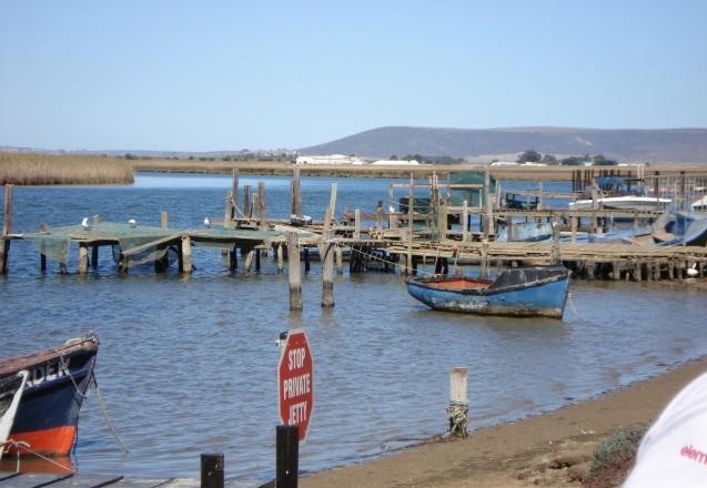
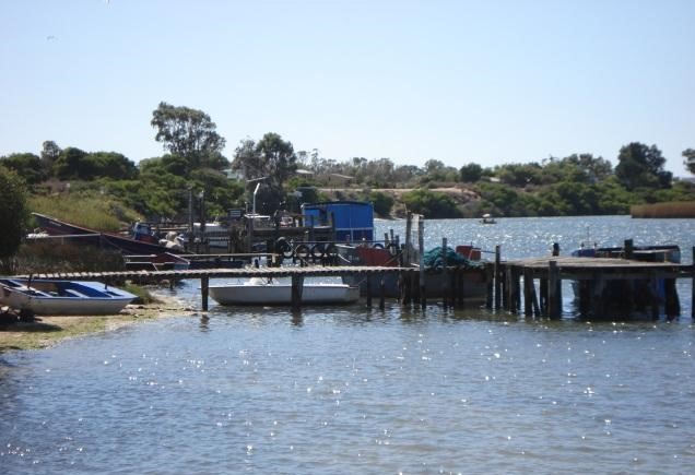
The north bank of the lower estuary is almost completely urbanized, extending from Laaiplek at the mouth through the Port Owen Marina a little further upstream to the town of Veldrif centered on the Carinus bridge.
Agricultural
About 65% of the Berg catchment was under agriculture, mostly temporary commercial dryland agriculture, permanent commercial irrigated agriculture, and commercial forestry
Livestock farming, plantation forestry, commercial industries, fruit farming.
Industrial
Fish processing factories and boat repairing/building facilities.
Cerebos Salt Works (now Royal Salt) and smaller commercial salt works.
Commercial net fisheries (beach seiner and gill net) on the west coast are likely to be the fisheries that benefit most from the Berg estuary.
In the present day the Berg estuary no longer contributes directly to commercial fish production as all commercial gill net permits for the estuary were rescinded by Marine and Coastal Management in 2003, in a move to abolish estuarine gill net fisheries due to excessive bycatch of juvenile line fish species.
Two commercial fishing ports are, however, situated in the lower estuary, one at the mouth and the other a little further upstream at the Carinus bridge. These fishing ports are used mostly by pelagic purse seiners fishing for sardine and anchovy in St Helena Bay and smaller gill net fishing vessel catching harders and St Josef sharks in the Bay.
Bokkom Bedryf (famous for West Coast fish drying strip).
Recreation
Fishing, water sport and hiking
Birdwatching
The Berg River canoe marathon which ends in Velddrif.
Ecology
Flora
Phytoplankton/Diatoms
Microalgae in estuaries comprise unicellular algae that either live suspended in the water column (termed phytoplankton) or benthically on rock or sediments in the estuary (termed microphytobenthos or benthic microalgae). These microalgae (i.e. phytoplankton and microphytobenthos) are very important in estuarine systems as they are generally the main source of primary production in the estuary.
Phytoplankton communities in estuaries are influenced by salinity, generally dominated by flagellates where river flow dominates and by diatoms in marine dominated situations. Diatoms are commonly dominant in the area of the estuary where the salinity is in the region of 10‐15 ppt, often referred to as the River‐Estuary Interface (REI) zone,. Phytoplankton biomass in an estuary is also generally at its maximum in this region. Biomass of phytoplankton in estuaries varies very widely and may range from 0‐210 μgChla/l (Adams et al. 1999). If nutrient concentrations in an estuary are high (particularly in the case of nitrogen) then phytoplankton biomass in the estuary is generally high too. Under extreme conditions, when nutrient levels are very high, certain toxic dinoflagellate species may form dense blooms known as red tides.
The micro algal community of the Berg estuary appears to be typical of South African estuaries in terms of community composition, and reflects the physical conditions of the estuary. Micro algae take the form of flagellates (water column only), blue‐green algae (benthic only) and diatoms (both). Micro algal abundance appears to be higher in winter than summer, in spite of lower water retention time, lower temperatures and higher turbidity in winter (Slinger & Taljaard 1994, Snow & Bate 2007). Phytoplanton biomass in the Berg estuary during winter has increased dramatically over the last two decades, most likely in response to the corresponding increases in concentrations of inorganic nutrients in the estuary. Average biomass of phytoplankton (measured as Chlorophyl a concentration) has increased from 1.8 to 8.2 μg/l in winter and from 0.2 to 1.2 μg/l in summer.
Algae
The macroalage are concentrated in the lower reaches of the estuary forming mats that cover the intertidal sand and mudflats. These algal mats were erroneously identified as being from the genus Cladophora in the past but have recently been confirmed as comprising two species of Enteromorpha ‐ Enteromorpha prolifera and E. flexuosa (Clark et al. 2007). E. flxuosa is is a common in northern European estuaries but has not previously been recorded in southern Africa and is most likely an introduced (alien) species. Enteromorpha prolifera, however, is an indigenous species. There is some evidence to suggest that the abundance of these macroalgae in the Berg estuary is increasing, which is of some concern given that they tend to cover large areas of sand and mud flat and either kills the invertebrates that live in these areas or at least prevent the birds that feed on these species from accessing their main food source.
Estuarine Vegetation
Dense stands of the indigenous reed Phragmites australis line the upper reaches of the Berg River Estuary. Sedgeland and reed beds occur along the floodplain and banks of the ;middel reaches of the estuary.
The lower reaches of the estuary include the third largest saltmarsh in the Cape. Sea grass occurs on tidally exposed and subtidal mudflats. The sago pondweed Potamogeton pectinatus occurs in brackish pools along the edge of the main channel. These plants provide food and habitat for estuarine fauna.
There are four main vegetation communities associated with the Berg estuary: macroalgae, submerged macrophytes, reeds and sedges, and salt marsh.
Semi-aquatic Vegetation
Subtidal vegetation is dominated by eel grass Zostera capensis in the lower estuary, which is replaced by fountain grass Potamageton pectinatus in the fresher upper reaches. Both Zostera and Potamageton also extend into intertidal areas, collapsing into dense mats at low tide. Structurally and functionally similar, these communities are largely separated by their salinity requirements. The extent of these two communities is strongly linked to flow, in that they readily replace one another when salinity distribution changes for any significant period. In the lower estuary, intertidal Zostera competes for space on mudflats with the various filamentous algae. The presence of Cladophera is highly seasonal, proliferating in spring and drying up over summer before being washed out of the estuary in winter (Kaletja & Hockey 1991, Clark et al. 2009).
At higher elevations, Zostera gives way to low‐growing intertidal salt marsh. Salt marsh composition is strongly zoned by elevation (i.e. degree of tidal inundation), with characteristic species progressing from cord grass Spartina maritima at lower elevations to soutbos Bassia diffusa, daisies Cotula spp and brakbos Sarcocornia perennis at higher elevations. Above the intertidal area of the lower estuary, the intertidal salt marsh gives way to supratidal salt marsh, dominated by a characteristic brakbos Sarcocornia pillansii and interspersed with bare patches. These areas are typically flooded in winter.
Terrestrial vegetation
Approximately 4% of the catchment was degraded, comprising mainly degraded shrubland and bushland. Roughly 30% of the Berg catchment was natural, mainly shrubland, bushland, grassland, and waterbodies and wetlands.
Fauna
Zooplankton
The zooplankton in the Berg estuary are numerically dominated by copepods (~98%), the remainder being made up of fish larvae, brachyuran larvae, mysid shrimps, amphipods and other organisms (Wooldridge 2007). Pseudodiaptomus hessei is the most abundant zooplankton species and is a major component in the diet of zooplanktivorous fish. Its distribution follows the typical pattern found in freshwater rich estuaries, being most abundant in the upper‐middle reaches. The euryhaline zooplankton community composition is similar to estuaries in other biogeographical provinces, possibly because of the general similarity of water temperatures within seasons in middle and upper estuarine reaches.
Estuarine Invertebrates
Invertebrates are an important food source for bird and fish in the estuary. The system supports an extremely high abundance of invertebrates, including polychaete worms, mud prawns and sand prawns.
Numbers of invertebrate species present in estuaries on the west coast are generally low compared to communities on the south and east coasts. Wooldridge (2007) attributes this to high river dominance of the estuaries on the west coast which frequently reduces salinity levels in the lower reaches of the estuary to levels below that suitable for many marine Berg Estuary Situation Assessment Anchor Environmental 31 species. This prevents stable stenohaline benthic marine communities (with narrow range of salinity tolerance) from establishing themselves in the lower reaches of these estuaries. The lower reaches of these estuaries are thus inhabited by an incursive marine zooplankton component that enters the lower reaches of these estuaries on the incoming tide, but leaves again on the outgoing tide.
The hyperbethos is dominated by larvae and post larvae of the crab Hymenosoma orbiculare, mysid shrimps and fish larvae. Mysid shrimps (mainly Mesopodopsis wooldridgei) and amphipods (mainly Corophium triaenonyx) dominate the hyperbenthos in winter.
The sub tidal benthos is numerically dominated by amphipods (mainly Grandidierella lutosa and Corophium triaenonyx) and polychaetes (mainly Capitella capitata) in summer and winter. Amphipods make up half to three quarters of the overall numbers of benthic invertebrates, with polychaetes dominating the remainder. Polychates tend to be more abundant in the lower half of the estuary, but both polychaetes and amphipods are most abundant in the middle reaches. Within groups, species replace one another along the estuary, according to their salinity tolerance. For example the amphipod Grandidierella lutosa is dominant in the lower estuary and is replaced by the highly abundant Corophium triaenonyx in the middle reaches. Mudprawns Upogebia africana are also abundant in the lower reaches as evident from the densities of burrows, and probably make up a very significant proportion of sub tidal invertebrate biomass.
Polychaetes (82%) (mainly Ceratonereis erythraensis), amphipods (11%) and isopods (4%) numerically dominate the inter‐tidal benthos. Density of inter‐tidal invertebrates is highest in the lower estuary, as is overall abundance due to the distribution of inter‐tidal area in the estuary.
Fish
Nearly 80% of the Western Cape coastal fish species have been recorded in the Berg River Estuary and floodplain. Of these fish, some are entirely estuarine or partially dependent on the estuary and floodplain. Over 30 fish species have bee recorded, including six estuarine residents (e.g. Estuarine Roundherring ), eleven euryhaline migrants (e.g. Flathead Mullet) , seven marine migrants (e.g. Elf and Leervis) and six fresh water species (e.g. Mozambique tilapia). The Southern Mullet is the most abundant species making up more than 80% of total catches.
Fish of the Berg estuary have been well studied, particularly in recent years (Bennett 1994, Clark et al. 2009). The ichthyofauna is typically dominated by the southern mullet Liza richardsonii, with the estuarine round‐herring Gilchristella aestuaria being second most abundant and occasionally dominant. These, together with bald goby Caffrogobius nudiceps, silverside Atherina breviceps, sand goby Psammogobuius knysnaensis and Mozambique tilapia Oreochromis mossambicus dominate the ichthyofauna. Of these, the latter is a freshwater species and Gilchristella is confined to estuaries; the others are marine species that occur in estuaries.
Marine migrants and estuarine residents are more‐or‐less equally abundant in summer, although the balance shifts from year to year, sometimes considerably in favour of the former (Clark et al. 2009). The relative abundance of these two groups can shift quite dramatically from year to year in winter, with marine migrants contributing up to 75% of numbers in some years, and the reverse true in others. Much of the variability is due to major fluctuations in the abundance of Liza richardsonii.
Liza richardsonii is a marine species that opportunistically uses estuaries. It is most abundant in the lowest 10 km, but extends all the way up the estuary in winter and summer. Other such opportunistic species, including elf Pomatomus saltatrix and white stumpnose Rhabdosargus globiceps, are confined to the lower reaches and are more common in summer than winter. Gilchristella (entirely resident in estuaries) occurs throughout the estuary during all seasons but is most abundant between 15 and 50 km upstream. Other estuarine residents (not confined to estuaries), such as Atherina breviceps and Psammogobuius knysnaensis, tend to be most abundant in the lower 30‐40 km of the estuary, some showing a distinct preference for higher salinities. The flathead mullet Mugil cephalus, the only commonly‐occurring marine species dependent on the estuary as a nursery area, is widely distributed throughout. Freshwater species, viz. Oreochromis mossambicus and carp Cyprinus carpia (both alien invasive) are found in the upper reaches in winter and tend to move down into the lower estuary during the dry summer months.
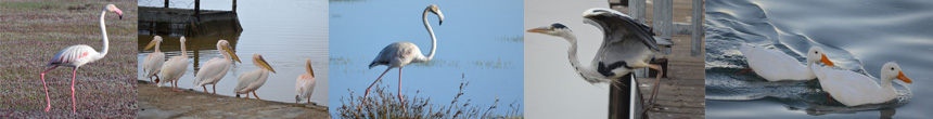
Birds
The floodplain supports at least 127 species of water birds. A number of large heronries occur within the Berg River floodplain. Riparian reedbeds also provide breeding habitat for large water birds, colonies of red bishops, various weaver species and populations of small warblers and cisticolas. Ducks, coots and blackwinged stilts breed in the sedge pans and South African shelducks breed in burrows near open pans.
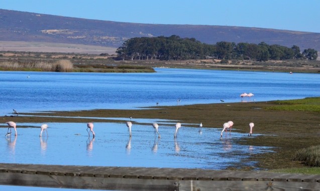
The estuary is one of the few suitable habitats along the west coast for migratory birds. Migratory waders on the East Atlantic, Mediterranean and Middel East flyways use the estuary as a feeding ground. The estuary supports approximately 250 resident bird species, representing 50% of the species of the South-Western Cape in the area. These include white Pelican, African spoonbill, Greater Flamingo and Lesser Flamingo. Little Blue Heron have also been recorded in the estuary.
The Berg estuary is recognised as one of the most important estuaries in the country in terms of its avifauna (Turpie 1995, Barnes 1998). It supports the highest recorded density of shorebirds on the West African Coast (Velasquez et al. 1991, Hockey et al. 1992), and supports nationally important populations of several species. The avifauna is relatively well‐studied, with numerous mid‐summer and mid‐winter counts having taken place (Summers et al. 1976, Hockey 1993, Taylor et al. 1997, ADU unpublished data, Turpie 2007a). There are fewer data on seasonal trends (Velasquez et al. 1991, Murison & Hockey 2004, Turpie 2007a).
Excluding exotic and vagrant species, some 92 non‐passerine1 waterbird species have been regularly recorded over the past 10 years, with an average of about 60 species being recorded on the estuary at any one time. Charadriiformes (waders, gulls and terns) account for 41% of the species recorded, with most of these being wader species. More than half of the 27 wader species are Palaearctic migrants. Apart from these and two migratory tern species, the remaining species are species that breed in South Africa, some making local or regional movements in response to rainfall. Among the resident species, the Ciconiiformes (herons, egrets, ibises, spoonbill) and Anseriformes (ducks) form the most diverse groups on the estuary, but most waterbird orders are well represented.
Apart from Egyptian and Spurwinged Geese and Cattle Egrets which mainly use the estuary for breeding and roosting, most of the birds found in the lower and upper estuary depend on the estuary for food. Thus the overall numbers of birds are likely to be influenced by the level of productivity of the estuary. Water birds feed on the full spectrum of organisms from micro algae to fish, all of which are positively influenced by freshwater flow up to a point.
Water Quality
Physio-chemical Characteristics
The distribution of saline water in an estuary (the longitudinal salinity distribution) is of fundamental importance in the estuary as it affects the distribution of all biota in the system due to their differing salinity tolerances.
During the summer low‐flow period, saline water penetrates the estuary up to at least 40 km from the mouth, depending on the tidal state. Freshwater inflow to the estuary during winter is sufficient to push the salt water entering the estuary back to within 10 km of the mouth.
Oxygen:The estuary is well‐oxygenated throughout the year, but slightly lower levels occur in summer (down to about 5 mg/l in the upper reaches) than winter (9‐10 mg/l) (Schuman 2007). Low oxygen water occasionally enters from the sea following intense upwelling events, which can very occasionally reach extreme conditions (Pitcher & Calder 2000).
Temperature is fairly uniform along the estuary during winter, typically 12‐15°C (Schuman 2007). In summer, the river water is warmer than the sea, and temperatures are typically above 20°C throughout the estuary except in the lowest reaches. Temperature in the lower estuary varies with tidal state, and can be as low as 12°C after upwelling at sea.
Nitrogen enters the estuary in both sea and freshwater, with sea inputs dominating in summer (low flow season), and river inputs dominating in winter (high flow season) (Clark & Taljaard 2007). Little change is evident in nutrient inputs to the estuary during the low flow season between 1990 and the present day (where inputs from the sea are clearly dominant. However, nutrient inputs during the high flow season (where riverine inputs are clearly dominant) have escalated dramatically between 1975 and the present day.
Total nitrogen concentration at the head of the estuary has increased from less than 300 ugl‐1 prior to 1980 (which was roughly equal to the input from the sea) up to almost 2000 ugl‐1 in 2005. Thus, riverine input of nitrogen is overarchingly dominant, nitrogen content being highest in the upper reaches in winter, decreasing downstream as it is used up, and exhibiting an inverse linear relationship with salinity. Under low flow conditions, nitrogen concentration is highest at the mouth because of nitrogen input from the sea, and decreases upstream.
Inorganic N and P: Under natural conditions, inorganic N and P inputs to the estuary from the Berg River was probably low considering that much of the catchment, especially that part from which perennial flow is derived, is comprised of Table Mountain Sandstone (TMS) which typically leaches very few ions (Bath 1993, Day 2007). Over time, however, human activities in the catchment have increased runoff of nutrients into the Berg River, hence increasing contributions from this source to the estuary. Principal amongst these have been land clearing (mostly for agriculture), application of artificial fertilizers, discharge of human wastes, and animal production (Bath 1993, Day 2007).
Sea water is the main source of phosphate in the estuary, with reactive phosphate levels being correlated with salinity. The linear correlation with salinity suggests, however, that this is not a limiting nutrient in the estuary, since there is no evidence of it being used up (Clark & Taljaard 2007).
Silicate levels are higher in freshwater than seawater, and declines linearly with salinity. This suggests that silicate is simply diluted by seawater and is not utilized significantly in the estuary (i.e. not limiting; Clark & Taljaard 2007).
Hydrodynamics and Mouth Dynamics
Hydrodynamics
- Length: 70km
- Area: 3 615 ha
- Depth: 5m below mean sea level
The Berg estuary mouth is stabilized between concrete breakwaters and dredged and therefore remains permanently open. Although tidal influence is detectable about 69km from the mouth, seawater does not penetrate this far (Schumann 2007). Tidal action attenuates rapidly upstream, and inter‐tidal areas occur mainly downstream of the Railway Bridge.
Dredging is periodically undertaken at the Port Owen Marina and the estuary mouth to facilitate the movement of sailing and fishing vessels in and out of the estuary and the marina. The construction of a new mouth may have reduced tidal flux in and out of the estuary to some degree, disrupting sediment transport processes in the mouth region. This could be the reason for the ongoing dredging that has had to be carried out in that region (Beck & Basson 2007).
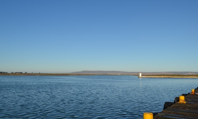
The Berg Estuary enters the sea through a permanently open mouth, canalised in the late 1966’s through the coastal dunes; the construction left a previous channel of the estuary as an appendix extending westwards of the mouth. The estuary meanders upstream through extensive dry pans, tidal flats and marsh areas, rising only 1 m in the first 50 km. The tidal oscillations propagate upstream about 69 km, although sea water has not been known to penetrate this far; Day (1981) has reported that a salinity of 9 was recorded at Kersefontein in February, 1979, some 45 km from the mouth.
Slinger and Taljaard (1994) undertook a preliminary investigation of this seasonal character of the Berg Estuary. Their results showed that during the rainy season (September) the penetration of seawater extended about 10 km upstream at flood tide, whereas in the following summer (February/March) this had reached farther than 40 km upstream. In all the sections measured, little vertical stratification of the water column was found. Water temperatures in the estuary were consistently warmer than in the sea, with the coldest temperatures in the sea in February (13.7 OC). There was no attempt to assess how typical the measurement period (1989/1990) was.
Mouth dynamics
The mouth of the Berg River Estuary is kept permanently open by a constructed channel and dredging. The estuary reflects strong seasonal paterns. River inflow during winter creates more turbid, freshwater dominated conditions, with limited saline intrusion near the mouth. During summer, the estuary becomes marine-dominated with less turbid saline waters penetrating up to about 40km from the mouth. Upwelling during these summer months is a typical feature along the West Coast when colder, nutrient-rich seawater is introduced into the estuary.
In 1966, entrainment of the mouth of the Great Berg Estuary occurred, owing to problems encountered by fishing vessels attempting to enter the sheltered harbour at Laaiplek (US, 1963). A new mouth was cut through the sand dunes and fixed in position about 1 km north of the original mouth position. The original mouth has since silted up completely and now forms a blind sidearm or lagoon running parallel to the coast (Eagle and Bartlett, 1984). The main channel of the estuary is about 250 m wide and 5 m deep in the vicinity of the mouth, generally becoming narrower and shallower with distance upstream. The average width and depth of the estuary are 150 m and 3 m, respectively.
Physical Features
Topography
The Berg River estuary is located 140 km north of Cape Town on the R27. It is one of the largest estuaries in South Africa and only one of four perennial estuaries on the arid west coast of Southern Africa. The estuary is about 33 km long (in a straight line) and consists of a highly sinuous main channel that’s tide dominated in the lower reaches, ephemeral pans, salt marshes, and intertidal mud flats.
The Berg estuary extends about 69 km from the mouth, based on the extent of tidal influence (Slinger & Taljaard 1994), although seawater does not penetrate this far (Schumann 2007).
Bathymetry
Tidal range at the mouth is 0.5 – 1.5 m, in the middle of the estuary (Railway Bridge) is 0.2 – 0.8 m, and in the upper estuary (Jantjiesfontein), is less than 0.2 m. Tidal flows in the lower estuary (at the R27 bridge) are 50‐100 m3.s‐1 and 200‐300m3.s‐1 during neap and spring tides, respectively (Beck & Basson 2007). Tidal action attenuates rapidly upstream, and inter‐tidal areas occur mainly downstream of the Railway Bridge.
The main channel at Veldrif is about 100‐200 m wide, becoming progressively narrower and shallower upstream. Depth is about 3‐5 m on average, up to 9 m in places. The total volume of the estuary is estimated to be about 12 Mm3 (Beck & Basson 2007).
The physical characteristics of an estuary are influenced by a range of different processes and driving forces. In particular, the following are important for the Berg estuary:
Sea level, comprising the ocean tide and other processes affecting sea level such as coastal trapped waves and weather effects. Over the long-term sea-level rise will also be important.
The characteristics of oceanic water entering the estuary such as temperature, salinity, dissolved oxygen, nutrients, etc.
The channel morphology. This will affect the manner in which water flows through the estuary, and the extent of the tidal prism. Important aspects here are the sill often found in the estuary mouth, tidal flats and land elevation. It is assumed that the estuary is permanently open.
The sediment structure of the channels and flood plains, and the sediment movement in and out and along the estuary. The vegetation on the estuary banks can also influence flow patterns.
The inflow of fresh water flowing into the estuary at its head, as well as the inflow of groundwater. The quality of this water.
The circulation of water in the estuary, and the mixing processes that occur between different water masses and the resulting structures and stratification.
Weather, in particular rainfall, air temperature and evaporation. It is also important to recognise that the climate of an area or region is not necessarily a constant, and that long-term changes can occur.
Obstructions
Increasing recreational use of the estuary, including consumptive natural resource use (fishing) and non-consumptive activities (water sports, birdwatching, hiking) is putting increasing pressure on resources and will likely lead to changes in the character of the area.
Climate
General
Warm dry summers and cool wet winters. Little rain falls during summer, with the rainy season extending from April to October.
Temperature
The mean annual temperature ranges between approximately 16°C in the east central to about 18°oC towards the west coast, with an average of 16° C for the Berg River Catchment as a whole. Maximum temperatures are experienced in January and minimum temperatures usually occur in July (DWAF 1994).
Rainfall
Receives most precipitation during the winter rainfall season.
There is a strong gradient in rainfall from east to west with the headwaters of the Berg in the east receiving relatively high volumes of rain and snowfall (ca. 5 000 mm per annum – Fourie and Görgens 1977). By contrast, the lower‐lying foothills and floodplain receive only 400 – 500 mm per annum, decreasing towards the sea.
Wind
The coastal ocean off the mouth of the Berg River falls into the Benguela upwelling system (Shillington, 1998). As the name implies, it is dominated by wind-driven upwelling, specifically in summer when south-easterly winds move surface waters offshore, allowing colder, nutrient-rich bottom waters to reach the surface at the coast. Nelson and Hutchings (1983) identified Cape Columbine as an upwelling centre, though waters in St Helena Bay remain warmer. North-westerly winds in winter correspondingly cause downwelling.
Threats
There are a number of factors that threaten the future health of the Berg estuary and hence its biodiversity and capacity to deliver ecosystem services. The main threats to the system or areas of potential conflict are as follows:
Water quantity and quality:
Reduction in freshwater inflows due to water abstraction in the catchment, and continuing increase in demand for abstraction;
Increasing nutrient enrichment due to agriculture in the catchment;
Potential risk of pollution entering from the harbour area and sea;
Exploitation of living resources:
Historical overexploitation of fish stocks and continued poaching with gill nets conflicting with nursery function;
Potential for future overexploitation by recreational fishers;
Land-use and associated disturbance:
Current and future residential/resort development around the estuary leading to change in sense of place and existence value, increased human disturbance of biota, and damage or loss of estuarine habitat;
Potential damage to environment and sense of place due to current and future harbour civil engineering and industrial activities; and
Tourism:
Increased demand for both nature‐wilderness based eco‐tourism and adventure type activities. Good management of tourism development will require providing facilities for and balancing the needs of both.
References:
- Ref 1: South African Estuaries: Catchment Land-Cover
- Ref 2: State of Rivers Report – Berg River System – 2004
- Ref 3: Preliminary investigation of seasonality in the Great Berg Estuary
- Ref 4: Berg River Baseline Monitoring Reports
- Ref 5: Berg Estuary situation assessment – October 2008 C.A.P.E. Estuaries Management Programme