Barberspan
- General Information
- Land uses
- Ecology
- Topography and Geology
- Hydrology and Geohydrology
- Climate
- Threats
- References
General Information
In 1971, the Barberspan Reserve already qualified as a wetland of international importance according to the Ramsar Convention of 1971 and was listed during 1975. The reserve is 3118 ha in extent, of which about 2 000 ha is water. The pan is connected with the Harts River via a channel and is the largest of a series of depressions along this channel. The pan itself is about 600m wide and 1 550m long. The Barberspan reserve comprises the following wetland types, namely, permanent river, stream or creek, permanent fresh water pools and perennial freshwater lake.
The pan is 11km long and 3.5km wide, and is named after Frederick Hugh Barber, who hunted along the Harts River in 1875 and not, as has been suggeste, after the barbel (baber in Afrikaans), a species of catfish found in South African rivers.
In 1913, Jan Christiaan Smuts, who owned a farm near the southern end of the pan, provided the labour and his foreman supervised the digging of a channel which diverted water from the Harts River into the pan, which lies about 9km lower than the river. The area is so flat that the Harts River now pushes enough water into Barberspan during the rainy season to last through the dry winter months, where previously the pan used to dry up during the dry season. This was ecologically important since the pan now became a large perennial water body in an area of otherwise seasonal pans and vleis. It became an oasis for birds (especially water fowl) which use it for feeding, drinking, roosting, moulting and breeding.
Land uses
Natural: The whole of the pan is protected as a Provincial nature reserve proclaimed in 1954 and is therefore State controlled.
Agricultural: The surrounding area is an agricultural area controlled by the farming community. Agricultural activities include cattle and maize farming.
Urban: Barberspan is situated 16 km northeast of Delareyville in the North West Province.
Recreational: The pan is also a popular angling resort and recreational area.
A camping and picnic site, a walking trail and bird hides have been established on the nature reserve.
Ecology
Terrestrial vegetation: The vegetation of Barberspan falls within the Dry Cymbopogon-Themeda veld, as classified by Acocks (Ref. 1). Relatively few naturally occurring trees and shrubs are found on the reserve. The most common naturally occurring trees and shrubs are Acacia karroo, Rhus lancea, Rhus pyroides and Diospyros lycioides. Common grasses are Themeda triandra, Cymbopogon plurinodes, Eragrostis lehmanniana, Eragrostis superba, Heteropogon contortus and Lippia scaberima. Aquatic vegetation is dominated by Potamogeton pectinatus.
The pH of the water ranges between 9,2 and 10,4. This hampers the growth of higher vegetation, which is usually present in the littoral zone of fresh waters. The vegetation of this zone is predominantly sedges (Juncus and Cyperus spp.). The vegetation of the littoral zone is predominantly sedge. In certain areas few or no sedges are found, being replaced by grasses which in places grow to the edge of or in the water.
A total of 226 plant species occurs on the reserve.
Aquatic vegetation: Phyto- and zooplankton are abundant.
Fish, amphibians and reptiles: Barberspan have only indigenous fish species. Eleven fish, amongst them, carp, barbel and yellowfish, nine amphibian and 28 reptile species were recorded.
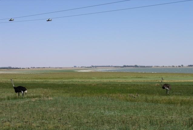
Birds: A total of 347 bird species have been recorded. Seven of these are classified as endangered. The pan is located in the Barberspan Bird Sanctuary, one of the largest waterfowl sanctuaries in South Africa.
It is one of the few permanent natural waterbodies on the western highveld and provides food and shelter during the dry months for large numbers of waterfowl, some of which breed in the wetlands. Migrating aquatic species use the pan as an important stopover. More than 320 species of birds have been recorded here, about one-fifth being migrants. A research station was established during 1952 for the ringing and study of waterfowl but is no longer operational. Approximately 40 000 birds of 190 species were ringed annually for study of their distribution and migration.
Barberspan is a very important stopover site for waterfowl, with over 320 recorded species including the Palearctic migrant species, such as the red knot (Calidris canutus) and black godwit (Limosa limosa). Species present include all indigenous waterfowl species except the tropical dwarf goose (Nettapus auritus). In 1975, Barberspan was the only locality in South Africa where the pintail (Anas acuta) has been recorded.
A number of Red Data bird species such as the African fish eagle (Haliaeetus vocifer), Openbilled stork (Anastomus lamelligetus), Goliath heron (Ardea goliath), Pinkbacked pelican (Pelecanus rufescens), White pelican (Pelecanus onocrotalus), Caspian tern (Hydroprogne caspia) and Yellowbilled stork (Mycteria ibis) also occur here.
It is of extreme importance to wetland avifauna populations that the pan is conserved as there are large numbers of birds which are dependent on it for stopover, breeding and foraging purposes.
Mammals: Several endangered mammal species occur in the Barberspan reserve. Rare mammals, such as the South African hedgehog (Erinaceus frontalis) and striped weasel (Poecilogale albinucha) occur on the reserve. Amongst the larger mammals, that thrive in the flat grasslands of the reserve are springbok, blesbok, black wildebeest and zebra as well as smaller mammals including jackal, porcupine, yellow mongoose and ground squirrel (Ref. 2). Two endangered mammal species occurs.
Topography and Geology
Topography and Geography: Barberspan is located (26o 35’S 25o 35’E) in the North-West Province, 17 km north-east of Delareyville at an altitude of between 1 345m and 1 360m above mean sea level. The depth varies from 5m to 9,5m flooding an area of 1 000 ha to 1 700ha. The storage capacity varies according to depth from 33 000m3 X 10 to 96 000m3 X 10.
Geology: Barberspan is the largest of a series of pans on the fossil bed of the Harts River. The reserve is underlain by amygdaloidal lava of the Ventersdorp System (age 2 100 million years). This is covered by surface limestone (age 100 million years) and classified as vlei or pan limestone according to origin. The quality varies from pure limestone to calcrete. It is hard and massive on the surface but softer and granular beneath the crust.
There are no known economic deposits of any minerals.
The area is generally gently undulating or very flat grassy plains. Hills seldom rising more than 130m above the surrounding flats.
Signs of previous human occupation of the area have been discovered. Primitive implements made of lava dating mostly to the Early Stone age (50 000 years B.P.) and Middle Stone age (10 – 40 000 years B.P.) have been found in quarries and on pebble outcrops. As yet no major cultural historic or archaeological finds have been made. However, the remains of General Smuts’s house are present which may be of interest to some.
Soils: Soils are shallow, alkaline and calcareous with sandy patches in certain areas. Mispah forms predominate in the reserve, while Katspruit forms are found near the water.
Hydrology and Geohydrology
No major rivers and streams are present in the area. The Harts River is the main source feeding the pan. The pan is connected with the Harts River via a channel. The pan itself is a natural, shallow, alkaline, perennial lake. Other pans in the vicinity are non-perennial.
Barberspan lies 9m lower than the Harts River. The water of the river fills the pan. During floods the river overflows its banks and not all the water enters the pan. The immediate catchment of the pan is 39 km2. The inflow from this source is a fraction of that from the Harts River.
Barberspan has a runoff of only 77 610m3 per year, while an average flow of over 60 times as much reaches it annually from the Harts River.
Barberspan is a wetland of international biogeographical importance. It is a dynamic system. The pan with its catchments represents a perfect and complete ecosystem in which the components are dependent on each other to maintain the ecological balance.
Climate
Barberspan can be described as an arid zone, with and average temperature of 18°C. Situated in the summer rainfall region the pan and its catchments receive their rains during the hot summer months and experience cool dry winters.
Precipitation: The rainfall over the entire catchment averages 557mm/annum. The mean number of days of frost in the province is 31. Occasional snow has been known to occur in the south and eastern regions.
Temperature: The annual average temperature ranges between 9°C to 27°C.
Wind: The predominant wind direction of the Northwest Province is from a northerly direction. There is a trend for the windy months to occur between August and November.
Threats
Threats are mainly external with pressure on the system arising from agricultural activities. The main threat to Barberspan is the agricultural pollutants, such as fertilizers, pesticides and herbicides.
Littering by anglers is also a problem.
Quarrying occurred previously and should be prohibited in the future.
References:
- Ref.1.Acocks J.P.H. (1953). Veld Types of South Africa. Botanical Survey of South Africa Memoir No.28. Government Printer, Pretoria. 1-192.
- Ref.2. Barberspan Nature Reserve
- Ref.3. De Villiers, Braam and Mangold, Stuart. The Biophysical Environment.
- Ref.4. Milstein, P le S. 1975. The Biology of of Barberspan, with special reference to the Avifauna. The Ostrich, Supplement no 10. : 1 -74.
- Ref.5. Barberspan South Africa.
- Ref 6. Wikipedia_Harts River