Buffels River
- Overview
- Tributaries
- Geophysical
- Hydrology and Geohydrology
- Ecology
- Climate
- Land-uses
- Populated Places
- References
Overview
The Buffels River drains the western ridge of the Bushmanland plateau north of the Kamiesberg, as well as the western slopes of the Bushmanland/Namaqualand escarpment inland of Kleinsee. It enters the sea on the West coast into the Atlantic Ocean, approximately 151 km south of the Orange River mouth. The Buffels River mouth is situated in the settlement of Kleinzee, which is controlled by De Beers Consolidated Diamond Mines (DBCDM).
The 2 main tributaries of the Buffels River are the Brak (41km) and the Riembreek rivers. These two tributaries join to form the Buffels River , approximately 149 km inland of the mouth. Numerous other smaller tributaries join the stream before it reaches the sea.
Although the Buffels River has the eighth largest catchment in the Cape , it only flows into the sea at times of exceptionally high rainfall.
Tributaries
| Name | Comment |
|---|---|
| Brak River | |
| Droë River | |
| Eenwilger River | |
| Gasab River | |
| Klein Nourivier | |
| Kommagas River | |
| Papkuils River | |
| Riembreek River | |
| Rooiplaatklip River | |
| Wolwepoort River |
Geophysical
Topography
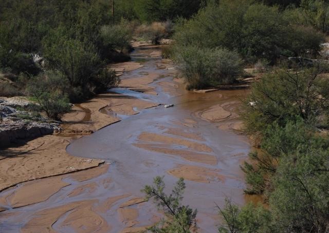
Kleinzee has rocky hills. The Buffels River has large, vegetation- covered white sand hummocks (Burrage, 1978).
Geology
Most of the area around the mouth consists of scrub-covered dunes, which show evidence of cross bedding in places. Inland, outcrops of calcrete eroded by marine terraces can be found and there is also evidence of strong metamorphic action.
The rocks in the area of the Buffels River are known as the Buffels, Marine Complex, which is a name given to the geological formations in the area by the geologists at Kleinsee. At the mouth these rocks belong predominantly to the Namaqualand-Natal granite gneiss series, which are seen as seaward dipping layered formations of quartz, micacious gneiss and schists (De Beers, 1979).
Soils
The Buffels River exhibits fine to medium, quartzitic sand (125 to 500 μm) with fine silt (7.8 to 15.6 μm) in places along its river course, but the typical fluvial sediment is coarse sand, 500 to 1000 μm (CSIR, 1981c; Cornelissen, 1968).
Hydrology and Geohydrology
Hydrology
Virtually all of the tributaries and the main river will probably only have surface flows after substantial rain. The Buffels River , itself, has very erratic flow and only reaches the sea during flood events, every 3 to 5 years. There two reasons for this, namely because the major part of the catchment lies in a low-rainfall-area (100 – 200 mm mean annual rainfall)and the geological formation of the river basin forms two large aquifers, which absorb much of the river flow. The high water table and the low salinity of the groundwater, however, suggest that subterranean flow occurs.
Ecology
Overview
The small Namaqua Rain Frog (Breviceps namaquensis) occurs in the dunes near the mouth of the river.
Terrestrial Animals
The following reptiles were recorded at Kleinzee (Burrage, 1978): Chondrodactylus angulifer , Agama atra , Mabuya occidentalis , Acontias lineatus , Eremias capensis , Meroles ctenodactyla , Psammophis crucifer.
In the phragmites marsh and upper river, 11 bird species were observed, of which the Cape Sparrow were the most abundant.
Mammal tracks were identified to establish that the following small mammals, such as surface burrowing moles, Water Mongoose, Bat-eared Fox, black-backed Jackal, Porcupine, Steenbuck, and Cape Wild Cats, occur along the river banks.
Vegetation
Aquatic vegetation comprise of small amounts of filamentous algae, which grows on the roots and debris of other vegetation in the pans.
Four species of semi-aquatic vegetation were observed:
- Eragrostis sabulosa
- Cotula coronipifolia
- Juncus kraussi
Terrestrial vegetation has been subjected to intensive human interference around the river, mainly the golf course. Nine main plant communities were identified, which were divided into 5 main plant formations, namely Reedswamp, Saltmarsh, Grassland, Low Shrubland and Dwarf Shrubland. The low shrubland covers the largest areas.
Climate
Rainfall
The Buffels River Catchment falls within the winter rainfall area. Episodic floods occur occasionally (Heydorn & Tinley, 1980).
The annual precipitation is 201 to 250 mm per annum, decreasing towards the west coast, which receives only 75 to 100 mm per annum.
The dominant wind direction measured (CSIR, 2000) at Kleinzee is south to south-south-west.
Land-use
Agricultural
Most of the land in the catchment consists of large, privately owned farms.
Sheep and goats are being farmed with extensively.
Dry land lucern is also cultivated.
Nature Conservation, Reserves and Tourism
Recreational activities such as diving, fishing and golfing takes place in the river mouth area.
Bird watching takes place at the estuary.
A conservation club has been established to manage the reserve situated between Kleinzee and Koingnaas (De Beers Report, 2005).
Mining
Intensive diamond mining takes place along the upper reaches of the riverbed. Copper mining takes place at the base of Spektakelberg.
Underground water extraction by the O’Kiep Copper Company, supply the surrounding towns and mines with water.
Populated Places
| Town | District | Municipality | River/Tributary |
|---|---|---|---|
| Bowelsdorp | Namakwa | Buffels river | |
| Buffelsbank | Namakwa | Buffels river | |
| Drierivier | Namakwa | Buffels river | |
| Grootmis | Namakwa | Richtersveld | Buffels river |
| Kamassies | Namakwa | Buffels river | |
| Kamieskroon | Namakwa | Nama Khoi | |
| Kleinzee | Namakwa | Richtersveld | |
| Langbaai | Namakwa | Richtersveld | Buffels river |
| Rooifontein | Namakwa | Buffels river | |
| Sandkop | Namakwa | Buffels river | |
| Springbok | Namakwa | Nama Khoi | Buffels river |
References:
CSIR (1981), Estuaries of the Cape , Part II. Synopses of available information on individual systems. Report no. 2. Buffels (CW3). CSIR Research Report 401.