Mdloti River
- Overview
- Tributaries
- Geophysical
- Hydrology, Geohydrology
- Ecology
- Climate
- Land-use
- Populated places
- Water Infrastructure
- References
Overview
The Mdloti estuary mouth is approximately 25 km north east of Durban Central and the length of the river is < 90 km.
The Zulu meaning (various meanings are given to the word Mdloti)
- the plough share
- the violent river
- the river of the bitter, wild tobacco plant
Tributaries
| Tributary | Comment |
|---|---|
| Gudwini River | |
| Kwazini River |
Geophysical
Geology
The river traverses Archaean Granite (Gneiss), Table Mountain Sandstone, Dwyka conglomerates (tillites), Ecca shale and recent deposits in its drainage basin . Borehole data reveals bedrock at 31 m to be Ecca sandstone Maud makes mention of a marine platform at the Mdloti lagoon 5.8 m above sea level, carrying on it an old oyster bed.
Hydrology and Geohydrology
Hydrology
The Mdloti river flows perennially. The mean annual average flow is given as 2m3/sec. These figures are representative of three-quarters of the total flow due to the position of the gauging station. The lowest daily flows in 1951/1952 were ,34m3/sec. The maximum flows recorded were 5 m3/sec. On 14 December 1964.
Ecology
Overview
According to Ref.1 (1978), juvenile eels were were observed at the foot of the Hazelmere dam. Fishes observed in the estuary include mullet, bream, river perch and spotted grunter before 1978.
Terrestrial Animals
According to Ref.1, an impressive amount of estuarine bird life is associated with the Mdloti estuary (1978) and the sand banks at mouth were important roosting sites for Common terns. During that time the estuary also hosted a large variety of waders in addition to species such as Egyptian and Spurwing geese and Yellowbill and wite face ducks.
Vegetation
One of the most impressive botanical characteristics of the mdloti lagoon is a dense and flourishing fringe of Barringtonia racemosa and above this is a hillside of well preserved coastal dune forest.”
One of the most impressive botanical characteristics of the Mdloti lagoon (on its southern bank) is a dense and flourishing fringe of Barringonia racemosa. Above this is a hillside of well preserved coastal dune forest. On the northern bank (seaward of the road) Casuarina has been planted. Most of the floodplain is intact, due to substantial proportion being under Barringtonia/Phragmites swamps. Some halophilous communities (e.g. Juncus) occur on semi-exposed mudflat areas adjacent to the water’s edge. However cane encroachment from the southern bank onto the head of the lagoon is noticeable.
Climate
Temperature
The mean annual temperature ranges between 12°C and 14°C in the west to between 20°C and 22°C at the coast. Maximum temperatures are experienced in the summer months from December to February and minimum temperatures in winter in June and July.
Land-use
Agricultural
The growing of sugar cane is the main agricultural activity in the catchment
Nature Conservation, Reserves and Tourism
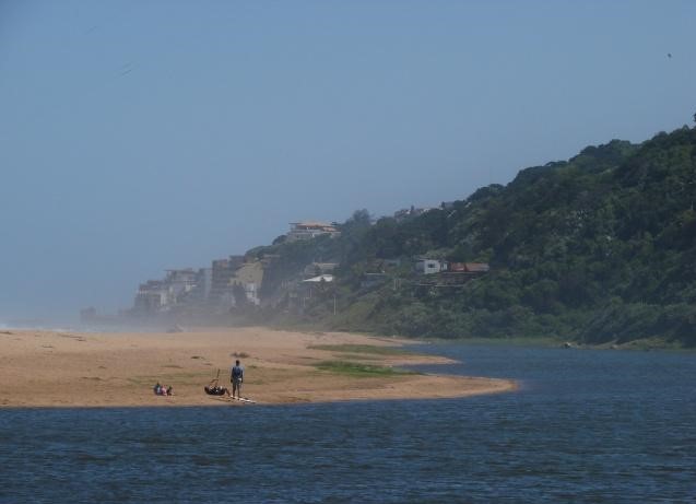
The Mdloti River takes its name from a species of wild tobacco which grows on its banks. At the river mouth is a spacious lagoon and the holiday resort of Umdloti, with bungalows and Bed and Breakfast establishments, overlooking a beach and a rock-enclosed tidal pool.
Industries
Tongaat Hulett Sugar Mill
Populated Places
| Town | District | Municipality | River / Tributary |
|---|---|---|---|
| Tongaat | Ethekwini | Ethekwini | Mdloti River |
| Verulam | Ethekwini | Ethekwini | Mdloti River |
| Umhlanga | Ethekwini | Ethekwini | Mdloti River |
Water Infrastructure
Dams
| Name | Capacity (mil.cub.m) | Comments |
|---|---|---|
| Hazelmere | 24 | Mdloti River. Approximate 20 km upstream of the estuary. The dam was constructed to supply the domestic, industrial and agricultural requirements and in expectation of Durban’s new international airport. Water is released from the dam for downstream irrigators and Tongaat Hullett. |
REFERENCES:
Begg, G. (1978) The estuaries of Natal.