Lourens River Estuary
- General Information and Location
- Catchment Characteristics
- Land and Estuary Uses
- Ecology
- Water Quality
- Hydrodynamics and Mouth Dynamics
- Physical Features
- Climate
- Threats
- References
General Information and Location
General
In the 17th century, the present Lourens River was know as the Tweederivier, since it was the second river crossed, after the Eerste River, on the journey from the Cape Peninsula towards the Hottentots Holland Mountains.
In 1976 it was named the Breitenbach, after a Lieutenant van Breitenbach. In the early 18th century it was referred to as the Laurens River after someone of that name was drowned in it, the spelling was subsequently changed to Lourens River, as it is still known today.
Location (co-ordinates)
The Lourens River flows through Somerset West in a south-westerly direction and enters the sea to the west of the Strand. The mouth is located at 34°06’S and 18°49’E, approximately 40km south-east of Cape Town.
Dimensions
During a survey in 1982, the lagoon measured approximately 300m long and 30 to 40m wide.
Catchment Characteristics
Main Rivers and tributaries
The river rises in Watervalkloof in the Hottentots Holland Mountains. It has a catchment area of 92km² and an approximate length of 20km. The river has no major tributaries, but is supplemented by streams arising in Landdroskloof and Sneeukopkloof.
Dams
Apart from a few farm dams in which surplus winter flows are stored for use in summer, there are no major in-channel dams along the Lourens River.
Land and Estuary uses
Residential
The villages of Somerset West and Strand are located next to the Lourens River.
Agricultural
There are no agricultural lands adjacent to the estuary, but in the middle reaches of the river there is still some agricultural land, used for grazing.
Industrial
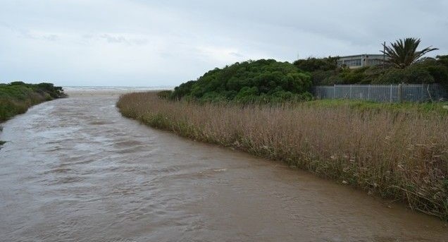
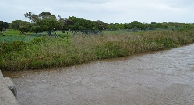
The Lourens Estuary lies in the restricted area belonging to the explosives company AECI. Just inland of the estuary the river is bounded by a golf course on the western side and a residential area on the eastern side.
Recreation
The Lourens Estuary is currently a bird sanctuary. The beach to the east of the AECI boundary, next to the Lourens Estuary is a public space used for recreational purposes such as swimming, sailing, picnicking, surfing and Life-saving training
Conservation
Between the mouth of the Eerste River and the mouth of the Lourens River, no fishing is aloud in the Helderberg Marine Protected Area, which stretches 500m seawards of the high water mark.Only shore angling (and no other type of fishing) is allowed between the mouth of the Lourens River, and the eastern breakwater of the harbour at Gordon’s Bay, extending 500 m seawards.
Ecology
Flora
Phytoplankton/Diatoms
A phytoplankton and diatom survey in 1982 revealed that there were various planktonic and epiphytic pinnate diatoms along with colonial green algae, such as Scenedesmus sp. and Coelastrum sp.
During a survey in the summer (December to March) of 1982, dense algal mats occurred on the surface and the bed of the estuary. These were identified as Cladophora sp., Enteromorpha sp., E. plumose and Chaetomorpha sp. The algal mats became less in April and in May they only occurred in isolated patches.
Algae
In 1982, no attached marine algae were found on the adjacent sandy beach.
Semi-aquatic Vegetation
In 1982, semi-aquatic vegetation comprised Juncus kraussi, Phragmites australis, Typha capensis, Cyperus textiles, Paspalum vaginatum and Scorpus nodosus.
No salt marsh vegetation occurred along the estuary.
Terrestrial vegetation
In 1982 the terrestrial vegetation comprises:
- Sparse covering of “pypgras” (Ehrharta villosa), “strandblommetjies” (Senecio elegans) and Trachyandra divaricata occurred in 1982 in the Fore Dune Area.
- A Disturbed Dune Vegetation area occurred in 1982 around the overflow pond, containing numerous dune plants, such as “kinkelbossie” (Tetragonia fructicosa), Carpobrotus edulis, “bergtee” (Geranium incanum) and Pelargonium capitatum. This area was however, disturbed by kikuyu (Pennisetum clandestinum). Acacia saligna and A. Cyclops have been cleared, but young plants had already reappeared.
- To the west of the overflowing pond was an extensive Typha capensis swampland. These swamps are considered to be important in filtering excessive nutrients from the overflowing pond, before it enters the sea.
- Immediately inland of the beach road is a weed area, where cover is sparse and a variety of weed, such as Conyza cf ambiqua, Sonchus oleraceus occurred in 1982.
Fauna
Zooplankton
In a zooplankton sample taken during a survey in 1982 the families Protozoa, Rotifera, Copepoda, Cirripedia and Osteichthyes (in the form of fish eggs) were represented, but most abundant, were the harpacticoid copepods, the copepods Acartia longipatella and the rotifers.
Aquatic Invertebrates
Aquatic invertebrates identified from trawls in the estuary, were midge larvae (Chiromidae). No prawn holes were observed.
Fish
After the spillage of raw sewage in 1982 into the estuary, a large amount of fish died, among them were white steenbras (Lithognathus lithognathus), harder (Liza richardsoni), sea barbel (Arius feliceps), leervis (Lichia amia) and elf (Pomatomus saltator)
Amphibians and Reptiles
As far as reptiles and amphibians were concerned, twelve frog species, of which the Cape Rain Frog (Breviceps gibbosus) is endangered; eleven snake species; eight lizards species, of which the Cape Dwarf Chameleon (Bradypodion pumilum) is endangered, and four tortoise species, of which the Geometric Tortoise (Psammobotes geometricus) is endangered, were recorded during a survey in 1982.
Birds
In 1981, a total number of 32 different bird species were recorded at the Lourens Estuary, of which the Common Tern, the Arctic Tern and the Red Cormorant were the most abundant.
Mammals
Mammals, such as the Cape clawless otter (Aonyx capensis), the Cape dune mole-rat (Bathyergus sucillus), the water mongoose (Atilax paludinosis), Steenbok (Raphicerus campestris) and Grysbok (Raphicerus melanotis) were observed near the Lourens Estuary between 1976 (Ref. 6) and 1980.
Water Quality
Physio-chemical Characteristics
During 1982, a tidal interchange was observed up to 1 300m from the Lourens River Mouth. During summer the estuary became hypersaline, as opposed to the salinity during winter, when the estuary became an almost completely fresh system .
In 1982, average water temperatures varied between 12°C in winter and 27°C in summer.
In 1982, transparency of the water was measured with a Secchi disc, which gave readings of approximately 100cm, when the mouth was closed and 74cm, when the mouth was opened.
The water was reported to be well oxygenated during the survey period from December 1981 to May 1982.
The pH measurements were lowest (between 4.1 and 5.4) during February and March 1982, due to the influx of water (pH = 3) from the AECI drain.
As far as nutrients were concerned, it was concluded that nitrate concentrations in the estuary can periodically reach very high levels.
Pollution
Pesticides, herbicides and fertilisers from the upper catchment reach the Lourens Estuary via the Lourens River.
Storm water drains from the adjacent residential areas drain into the Lourens Estuary via the Lourens River.
Waste products are dumped all along the river, polluting the estuary and subsequently also the adjacent beach.
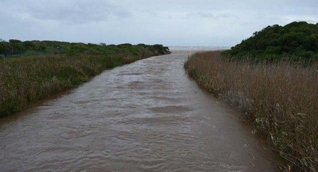
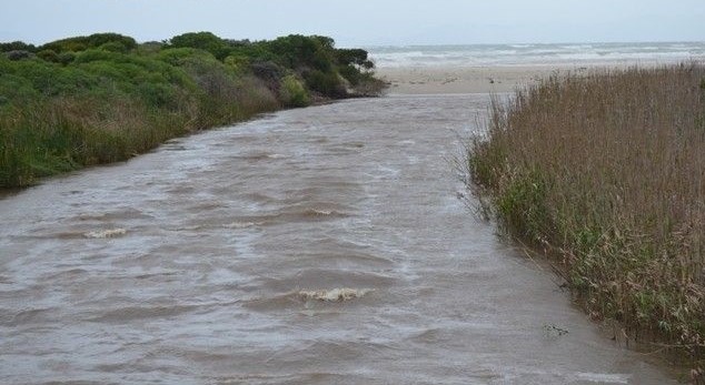
Hydrodynamics and Mouth Dynamics
Hydrodynamics
The dynamics of the Lourens River estuary and mouth is mainly controlled by the hydro-sedimentological mechanics of the beach bar which dams up the lagoon. River flow will influence the size and configuration of the lagoon in so far as rising water levels will overflow or breach the beach bar at a lower section.
Mouth dynamics
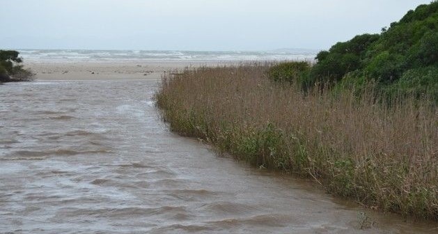
In 1982 (Ref.2.) the mouth area of the Lourens River was very similar to that of the Eerste River, except that the dune belt, through which the Lourens River flows to reach the beach, is much flatter and is artificially disturbed by developments of the western parts of the Strand. The beach bar was 2m high during the 1982 survey in July. Occasionally, during the dry summer season, the lagoon is closed or has only a small outflow to the sea.
Fine to course sediments are present in the lagoon. Te finer fractions are found along the landward bank of the lagoon and medium sand occurred at the seaward side, due to the wave wash over the beach bar.
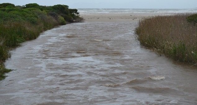
Physical features
Topography
On the western side of the mouth, a flat landwards inclined backshore (+ 2m above MSL) containing the lagoon, extends until reaching the elevated dune belt (3 to 4 m above the backshore). On the eastern side the estuary is bounded by development in the Strand.
Bathymetry
During May 1982 the estuary depth was measured as 1.5m.
Obstructions
The bridge at the head of the estuary.
Climate
General
The climate is typical Mediterranean. Summer is from December to May. Winter stretches from June to August, with many sunny days and the wind generally mild, with the occasional high winds. Spring (Sep-Nov) is idyllic with balmy days and warm evenings.
Rainfall
The rainy season is in the winter. Annual rainfall varies between 20mm in February and 120mm in June.
Threats
In 1982, potential toxic levels of pesticides have been recorded in the river which could have resulted in changes in the aquatic invertebrate community.
During 1982, the water quality of the water in the lower reaches of the Lourens River has been reduced largely as a result of storm water run-off from increasing urban, industrial and commercial areas. Since 1982 development along the lower reaches increased substantially, although industrial practices on the western side (AECI) were reduced.
References
- Ref.1. Heap, P. (1977). The story of Hottentots Holland. 2nd edition. Cape Town. A. A. Balkema. 199pp.
- Ref.2. Cliff, S. and Grindley, J.R. (1982). Estuaries of the Cape. Part II. Synopses of available information on individual systems. Report No. 17. Lourens (CSW 7). CSIR Research Report 416.
- Ref.3. River Health Programme (2003). State-of-Rivers Report: Diep, Hout Bay, Lourens and Palmiet River Systems. Dept. of Water affairs and Forestry, Pretoria, 39pp.
- Ref.4. Recreational fishing (2005). http://www.environment.gov.za/HotIssues/2005/fishingBrochure/RECREATIONAL_FISHING_Bro.pdf
- Ref.5. Bally, R. et al. (1980). The environmental effects of effluents from a food canning factory on a sandy beach ecosystem in False Bay. School of Environmental Studies. University of Cape Town. 55pp.
- Ref.6. Meester, J. A. J. (1976). South African red data book – Small mammals. S. Afr. Natl. Sci. Programmes Report 11. 59pp.
- Ref.7. Stuart, C. T. et al. (1980). Preliminary distribution maps of mammals of the Cape Province (excluding Cetacea). Cape Department of Nature and Environmental Conservation (unpublished research report). 174pp.