Berg River
- Overview
- Tributaries
- Geophysical
- Hydrology; Geohydrology
- Ecology
- Climate
- Land-uses
- Populated Places
- Water Infrastructure
- References
Overview
Upper Berg River: This area extends from the source of the Berg River in the Franschhoek Mountains to Misverstand Dam, south of Piketberg.
Lower Berg River: The area includes the Berg River catchment between Misverstand Dam and the Berg River mouth. It includes the smaller rivers which drain some West Coast catchments direct to the sea, and the catchment of the Diep River.
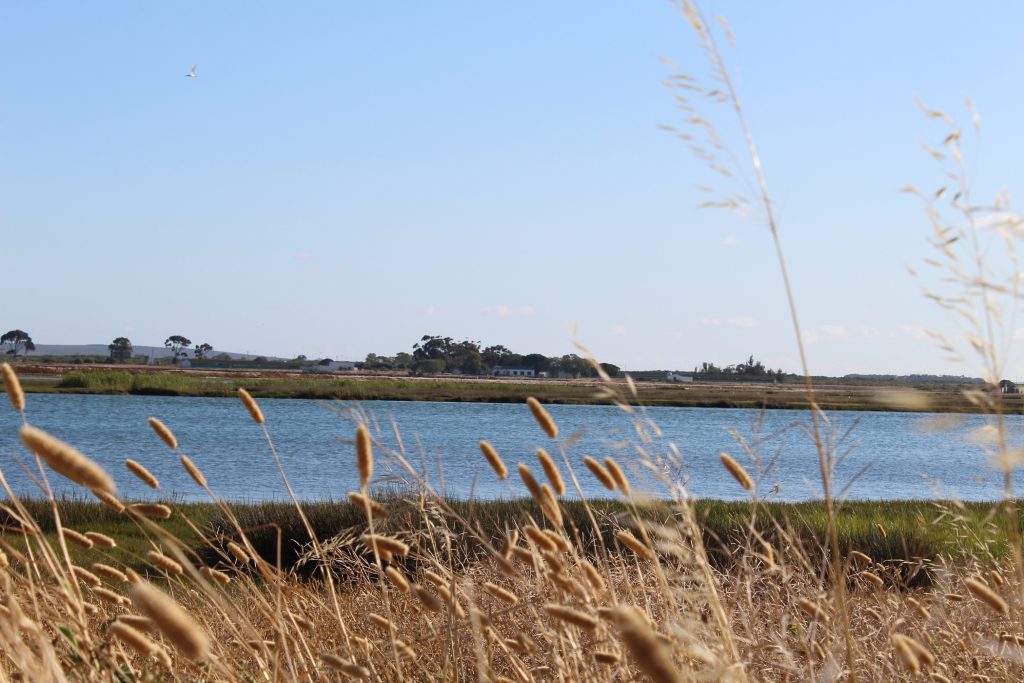
The most important water source for the Boland and Cape Peninsula.
The Berg River rises in the Franschhoek and Drakenstein mountains. It flows northwards past Paarl, Wellington, Hermon and Gouda, where it is joined by the Klein Berg and Vier-en-Twintig rivers. The Berg River then flows westwards past Porterville, Piketberg, Hopefield and Velddrif to discharge into St. Helena Bay on the west coast.
The Berg River drains an area of approximately 8 980 km2 and has a total length of about 285 km. It has nine major and seven minor tributaries, six of which were naturally perennial, namely the Franschhoek,Wemmershoek, Dwars, Klein Berg, Vier-en-Twintig and Matjies rivers.
The Berg River has its source in the Drakenstein and Franschhoek Mountains south of Franschhoek and discharges into the Atlantic Ocean near Velddrif, some 285 km away. (Berg River Baseline Monitoring Programme Final Report: Volume 1, September 2007).
The Berg River drains the western slopes of the Olifants River Mountains, the Winterhoek Mountains and the Drakenstein Mountains as well as the Swartland. The origin is at Franschhoek in the Franschhoek Mountains.
Tributaries
| Name | Comment |
|---|---|
| Klein Berg River | (from the Voëlvlei Dam) |
| Twenty Four Rivers | draining the Groot Winterhoek Mountains |
| Krom River | draining the Swartland between Piketberg and the Olifants River Mountains |
| Boesmans River | draining the Piketberg Mountains |
| Soutrivier | draining the Swartland west of Moorreesburg |
| Franschoek River | |
| Wemmershoek River | |
| Matjies River | |
| Dwars River |
Geophysical
Topography
The Berg River rises in the Franschhoek and Drakenstein mountains at an altitude of 1500 m. It flows northwards past Paarl, Wellington, Hermon and Gouda, where it is joined by the Klein Berg and Vier-en-Twintig rivers. The Berg River Catchment covers an area of almost 9 000km2 and is the largest catchment in the Western Cape Province. Berg River Baseline Monitoring Programme Final Report: Volume 1, September 2007.
The river then flows westwards past Porterville, Piketberg and Velddrif where it finally discharges into St. Helena Bay on the west coast. Based on geographic and topographic characteristics, the catchment can be divided into three distinct areas, namely the broad, flat extensive western portion west of Moorreesburg and Koringberg, the river valley portion east of Koringberg to just south of Paarl, and the upper mountainous source area south of Paarl.
Major towns in the western portion include Saldanha, Vredenburg and Hopefield while key towns in the central river valley area include Piketberg, Porterville, Paarl and Wellington. Franschhoek is found at the base of the Franschhoek Mountains some 6 km north east of the proposed Berg River Dam site. The total population of the catchment is in the order of 200 000, most of whom live in the urban areas.
Much of the catchment area is flat, with an average topographical gradient between Paarl and the mouth of the Berg River at Laaiplek of 0.001. Topographically, a north-trending ridge of mountains (Piketberg, Swartberg) divides the catchment in two, with the Berg River flowing through a poort between Koringberg and De Hoek. Mountains that reach in excess of 1 000 m elevation flank the north trending valley in the eastern part of the catchment, including the Groot Winterhoek Mountains, Kasteelberg, Perdeberg, Paarl Mountain and the Wemmershoek Mountains.
Geology
The Berg River Catchment comprises sequences of rocks of the Malmesbury Group, the Cape Granite Suite, the Klipheuwel Group, the Table Mountain Group and younger Cenozoic sediments in the western part of the catchment. The Malmesbury Group and Klipheuwel Group essentially comprise soft, erodible rocks that form flat plains in low lying areas. In general, these areas have moderate to high agricultural potential. The Malmesbury Group is steeply folded along a north west striking axis (Visser 1989). Berg River Baseline Monitoring Programme Final Report: Volume1, September 2007 These metasediments form part of the Saldania Subprovince and have been subdivided into three tectono-stratigraphic domains, i.e. the Tygerberg, Swartland and Boland domains. These domains are separated by two major north-northwesterly striking fault systems, namely the Franschhoek- Saldanha (Colenso Fault) and Wellington-Piketberg Faults (Visser 1989).
Outcrops of Cape Granite Suite rocks occur in the west, south and south east of the catchment. This series of granitic plutons, of late Precambrian to early Cambrian age, intruded into Malmesbury Group. Older intrusions occurred between 610 and 560 Ma, while the younger phase occurred between 540 and 500 Ma (Timmerman 1988). In places they form prominent features like the Paarl Mountain.
The Table Mountain Group comprises hard resistant quartzitic sandstones that form the mountain ranges that flank the north-trending river valley in the east. The rocks have been folded and faulted, giving them their secondary water-bearing features.
Upper Berg River: Table Mountain Group (quarzitic sandstone), Sandy sediments
Upper Middle Berg River: Table Mountain Group (quarzitic sandstone), Malmesbury Group (shale), Cape Granite Suite, Sandy sediments
Lower Middle Berg River: Table Mountain Group (quartzitic sandstone), Malmesbury Group (shale), Klipheuwel Group, Sandy sediments
Lower Berg River: Table Mountain Group (quartzitic sandstone), Malmesbury Group (shale), Cape Granite Suite, Sandy sediments
The siliceous Table Mountain Group (TMG) produces soils that are acidic and infertile.
Soils derived from the Cape Granite are also more fertile and finer textured than those derived from the Table Mountain Group.
Hydrology and Geohydrology
Hydrology
The Berg River has its source in the Drakenstein and Franschhoek Mountains south of Franschhoek and discharges into the Atlantic Ocean near Velddrif, some 285 km away. Major tributaries of the Berg River include the Franschhoek, Wemmershoek, Dwars, Kompagnies, Klein Berg, and Twenty-four Rivers. A striking characteristic of the catchment is the low density of drainage channels in the western parts of
the catchment underlain by unconsolidated sandy recent deposits. Significantly higher drainage densities are observed in the central and eastern parts underlain by weathered and fractured rocks, mostly of the Malmesbury and Table Mountain Group.
Two major dams have been built in the catchment. The Wemmershoek Dam south east of Paarl has a surface area of 3 km2 and a storage capacity of 66 million m3. The Voëlvlei Dam west of Tulbagh covers an area of 15 km2 and has a storage capacity of 170 million m3. Numerous smaller farm dams are found throughout the east part of the catchment. Total natural runoff from the Berg River Catchment amounts to 931 million m3/a. These three catchments make up only 7% of the total area of the Berg River catchment. The estimated size of the catchment area of the Berg River Dam is about 70 km2, which is less than 0.8% of the total area of the Berg River Catchment. DWAF (1993) estimated present-day annual runoff of the Berg River amounted to 682 million m3/a, with the modified flow attributed to direct abstraction from the river for irrigation, storage and abstraction for urban water supply, development of forestry within the basin, irrigation return flow, and releases from the Voëlvlei, Wemmershoek and Theewaterskloof Dams (the latter via the Berg River Syphon).
Flow and quality characteristics of the Berg River have been severely modified by abstraction from the river and the release of some 17 million m3/a of summer irrigation water from the Theewaterskloof Dam into the upper Berg River at the Berg River Syphon upstream of the proposed Berg River Dam site (1993 data; current releases amount to between 50 and 60 million m3/a). This water is used to supply irrigators downstream as far as Zonquasdrift. Downstream of Zonquasdrift, irrigation water is released from Voëlvlei Dam.
It is of interest to note that in the geological past, the Berg River flowed from Assegaaibos past the position of the present tunnel siphon, straight past Robertsvlei camp and northeast down the Roberts River into the Franschhoek River. A mountain landslide resulted in blocking the upper reaches of the Robertsvlei gap, thereby causing the river to change its course to the present course through the proposed Berg River Dam site (Forbes, Dick and Associates 2001). The Berg River catchment falls within the winter rainfall region of the south-western Cape. Rainfall in the catchment increases from west to east.
Ecology
Overview
UPPER BERG RIVER and TRIBUTARIES – Habitat integrity and water quality in the Berg River deteriorate downstream as a result of alien vegetation encroachment (Acacia sp.), the interbasin transfer of water and river modification. Urban and agricultural development affect the water quality at Franschhoek (municipal and wine farm effluent). The lack of environmental flow releases from Wemmershoek Dam results in a severely altered flow regime and habitat downstream.
UPPER MIDDLE BERG RIVER and TRIBUTARIES –River health is reduced in the tributaries as a result of alien vegetation infestation and agricultural development (river modification, water abstraction, runoff). Water quality and habitat integrity in the Berg River and lower reaches of these tributaries are reduced due to urban development
LOWER MIDDLE BERG RIVER and TRIBUTARIES- Diversion weirs in the Klein Berg and Vieren-Twintig rivers have altered flow patterns. Alien fish (bass and banded tilapia) are widespread and have led to the disappearance of indigenous fish (Berg River redfin and whitefish). River health is also reduced by the effects of agriculture (levees and pesticide residues). Water quality and habitat integrity near Tulbagh are poor.
LOWER BERG RIVER and TRIBUTARIES- Farming practices (riparian vegetation removal, bed modification, water abstraction) and alien vegetation (black wattle, river gum) impact on the habitat integrity and flow of the rivers. Flow releases are made from the bottom of Misverstand Dam and reduce water quality. Alien fish (banded tilapia and carp) prey on or compete with indigenous fish.
Vegetation
Spatial distribution and variation of vegetation is strongly correlated with geology, and to a lesser extent rainfall and other climatic variables. The siliceous Table Mountain Group (TMG) produces soils that are acidic and infertile, resulting in areas with low agricultural potential (Schloms et al. 1983). In general, fynbos is prominent in these areas, but forest can develop in moist sheltered ravines (Cowling and Holmes 1992). Rocks of the Malmesbury Group are regarded as being moderately high in nutrients. These rocks are generally finer textured than those of the TMG and include phyllite, schist, greywacke and shales. Soils derived from the Cape Granite are also more fertile and finer textured than those derived from the TMG. Renosterveld dominates the vegetation on these soils, but may give way to fynbos in areas with higher rainfall (Rebelo 1996). Along the West Coast, soils derived largely from coastal processes can broadly be divided into calcareous sands and limestones, and non-calcareous (neutral to acidic) sands. These soils support a number of coastal vegetation types such as Strandveld and Sand Fynbos. Much of the natural vegetation in the catchment has been destroyed to make way for urbanisation and agriculture. It is only in the higher lying areas and areas with low agricultural potential that natural vegetation prevails. The vegetation coverage was obtained from the National Botanical Institute (Mucina and Rutherford 2005.). Berg River Baseline Monitoring Programme Final Report: Volume 1, September 2007
UPPER BERG RIVER: Fynbos (Sandstone, Alluvium, Afromontane Mires)
UPPER MIDDLE BERG RIVER: Fynbos (Alluvium, Afromontane Mires, Sand, Sandstone), Renosterveld (Shale, Granite)
LOWER MIDDLE BERG RIVER: Fynbos (Sandstone, Shale, Alluvium), Shale Renosterveld LOWER BERG RIVER: Fynbos (Sand, Sandstone, Alluvium), Renosterveld (Shale, Granite, Silcrete, Alluvium).
Climate
Temperature
The mean annual temperature varies between 16°C in the east to 18°C along the West Coast, with an average of 16°C. Maximum temperatures are experienced in January (average daily max = 29,4°C) and minimum temperatures usually occur in July (average daily min = 4,5°C). Temperatures along the coast are a few degrees cooler than in the interior.
Rainfall
The majority of the rainfall occurs between the months of May and September and hence it is referred to as a winter rainfall region.
Rainfall is of a frontal nature, generally moving from the Atlantic Ocean to the north-west over the Western Cape. The orographical influence of the high mountain ranges in the Cape Peninsula and on the eastern side of the water management area, introduces a large spatial variability in the mean annual precipitation (MAP). In the high lying areas of the Upper Berg River, the upper reaches of the Eerste River and the Steenbras River, the maximum mean annual precipitation exceeds 3 000mm per annum.
In the lowlands, the precipitation is between 600mm and 400mm per annum, being greater in the small mountain outcrops and hills and reducing to 300mm per annum in the north-west , where the Berg River flows into the sea. The average potential mean annual evaporation (measured by S-pan) ranges from 1 400mm in the south to 1 700mm in the north.
The Berg River Catchment experiences a Mediterranean climate with warm dry summers and cool wet winters. Rainfall is of a cyclonic nature, extending normally over a few days with significant periods of clear weather in between. Little rain falls during summer, with the rainy season extending from April through to October.
Land-use
Agricultural
Wine grapes: Viticulture is an important agricultural activity practice in the southern part of the Berg River catchment and centered around Paarl, Wellington and Franschhoek.
Wheat: The Swartland is one of the major wheat producing areas in South-Africa. The main centres are Malmesbury, Moorreesburg and Piketberg.
Other: Deciduous fruit is the backbone of the economy in the Berg River catchment. North of Wellington, dryland grain farming and sheep farming predominate. Commercial pine forests occur near the headwaters, around Franschhoek. The major industries in the Berg River basin are agriculturally based and include wineries, canneries and other food processing factories.
Populated Places
| Town | District | Municipality | River/Tributary |
|---|---|---|---|
| Laaiplek | West Coast | Bergrivier | Berg River |
| Velddrif | West Coast | Bergrivier | Berg River |
| Hopefield | West Coast | Saldanha | |
| Moorreesburg | West Coast | Swartland | |
| Piketberg | West Coast | Bergrivier | |
| Riebeeckwes | West Coast | Swartland | |
| Gouda | Cape Winelands | Drakenstein | |
| Porterville | West Coast | Bergrivier | |
| Wellington | Cape Winelands | Drakenstein | Berg River |
| Paarl | Cape Winelands | Drakenstein | Berg River |
| Simondium | Cape Winelands | Drakenstein | Berg River |
| Tulbagh | Cape Winelands | Little Berg river, tributary of the Berg River | |
| Franschoek | Cape Winelands | Stellenbosch | Berg River |
| Pniel | Cape Winelands | Stellenbosch | Dwars River, tributary of the Berg River |
| De Hoek | West Coast | Swartland |
Water Infrastructure
Dams
| Name | Capacity (mil.cub.m) | Comments |
|---|---|---|
| Wemmershoek Dam | 58.7 | The dam wall was completed in 1957, and is in the Wemmershoek River. |
| Voëlvlei Dam | 158.6 | The dam is supplied by diversion works from the Klein Berg, Vier-en-twintig and Leeu Rivers |
| Misverstand Dam | 6.4 | East of Piketberg |
| Berg River Dam | 126.4 | The construction of the Berg River Dam (Berg Water Project) commenced in 2005. The dam is situated near Franschhoek in the upper catchment of the Berg River. |
Water Treatment Works
- Erica Derelict Water Works
- Tulbagh Water Works
| Name of works | Max Capacity (mil.cub.m) | Comments |
|---|---|---|
| Piketberg | Activated sludge and maturation ponds. Effluent is disinfected. Effluent disposal: Irrigation | |
| Moorreesburg | 2.5 | Bio-filters, activated sludge and maturation ponds. Effluent is disinfected. Effluent disposal: Watercourse. |
| Velddrif | Bio-filters and maturation pond. Effluent disposal: Irrigation |
REFERENCES:
STATE-OF-RIVERS REPORT RIIVER HEALTH PROGRAMME BERG RIVER SYSTEM – 2004
Department of Water Affairs and Forestry, South Africa. 2004. Berg Water Management Area: Internal Strategic Perspective. Prepared by Ninham Shand (Pty) Ltd in association with Jakoet and Associates, Umvoto Africa and Tlou and Matji, on behalf of the Directorate: National Water Resource Planning. DWAF Report No P WMA19/000/00/0304.